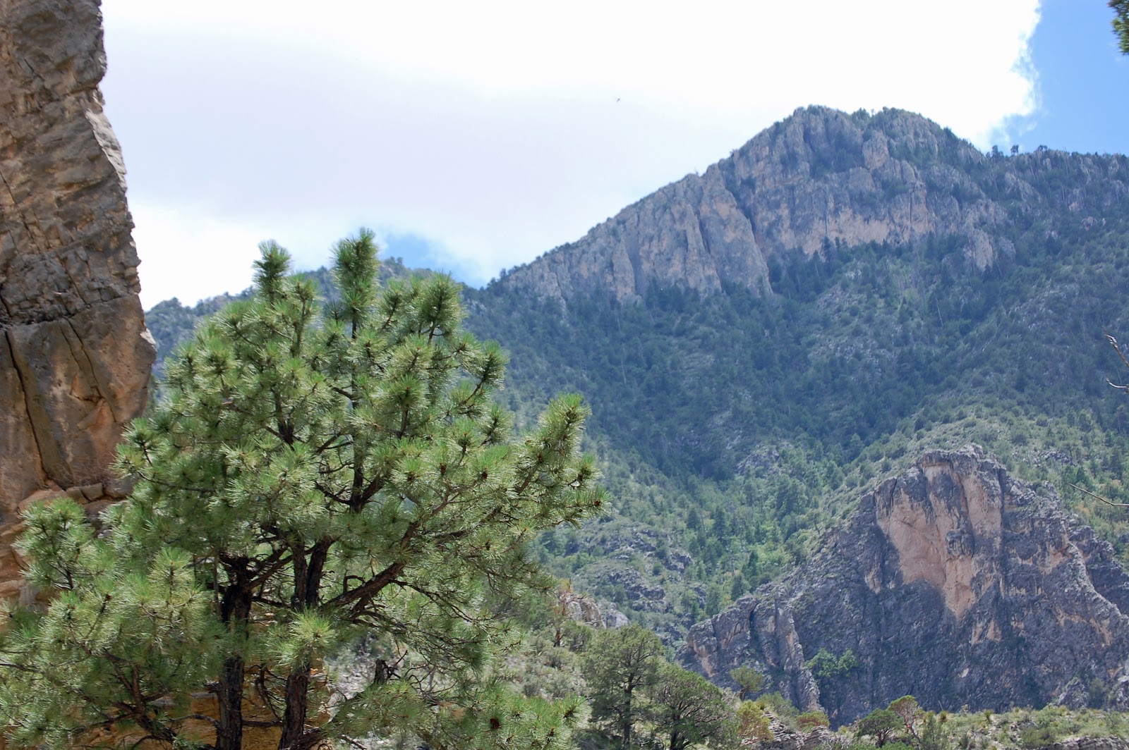
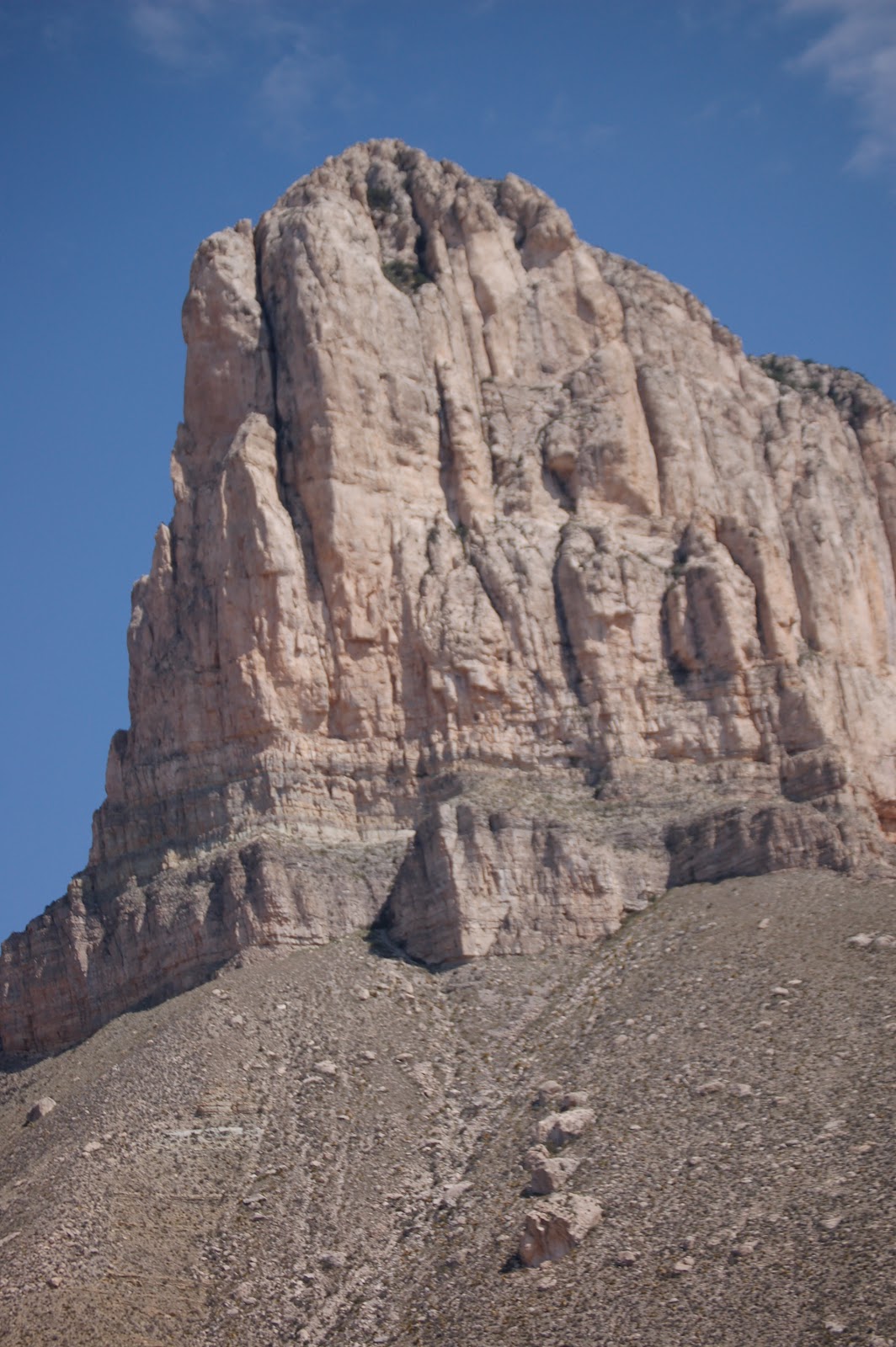
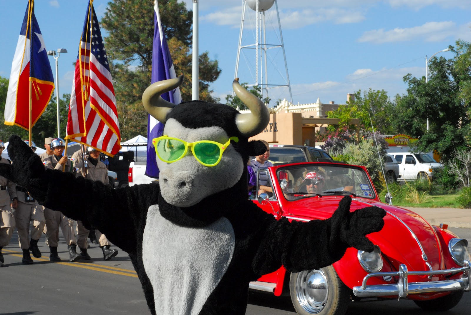
Friday afternoon, we hiked the Lost Mine Trail in Big Bend National Park...the entire Big Bend region is GREEN because we've had some nice rain. Come on out soon and see it for yourself!
Your daily photo of gorgeous Far West Texas featuring Big Bend National Park, the Davis Mountains, Guadalupe Mountains National Park, El Paso and all points in between!
Sunday, September 09, 2012
Saturday, September 08, 2012
Just hanging out?
![]() |
| (click on the photo for a closer view) |
Friday, September 07, 2012
Adventures in the Guadalupes, Hiking the El Capitan Trail
| Guadalupe Peak, the highest in Texas |
by
Andrew Stuart
Editor, Hudspeth County Herald and Dell Valley Review
Texas Mountain Trail Board Member
Editor, Hudspeth County Herald and Dell Valley Review
Texas Mountain Trail Board Member
The
trail passes from the grassy foothills of the eastern slopes to the stony
defiles below Capitan's tower, to the crest of the Salt Basin Overlook, at the
southern foot of El Capitan; from the overlook, the trail winds through sharp
and exposed terrain along the western face of the mountains, above vertiginous
heights and below the 2,000-foot cliffs of the escarpment, to the head of
Shumard Canyon. The path then drops down through the canyon's gorge to the
historic Williams Ranch House, built in 1908. On the return, the Salt Basin
Overlook Trail winds along the ledge below El Capitan, through a wonderland of
boulders. The trails can be taken as a shorter, 11.5-mile day hike, excluding
the leg from Shumard Canyon and back.
I carried, among other things, a sleeping bag, a tent, a light-weight camping
stove, some dishware and two gallons of water. A package of powdered,
just-add-water food. Early in the hike, feeling the weight of the water on my
back, it occurred to me it would be nice if someone would invent powdered
water. I guess, you know, you'd just add water.
| View from the east |
Around
the base of El Capitan, coming to the Salt Basin Overlook, and a sudden view of
much of Hudspeth County: the Patterson Hills, the flats and dunes, Round
Mountain – a little blemish on the flats, casting a tiny shadow; the Cornudas –
San Antonio, Chatfield, Wind mountains, Cerro Alto in the far distance, at the
El Paso County line; and, hazy in the southwest, Sierra Blanca, Little Blanca
and Round Top mountains.
I
spent a day and a half out in the wilderness, in the park, I sweated and
labored around boulder and cliff, with the broken rocks below and before me,
over pass and then pass again, circling, twisting about the colossus of El
Capitan. Oh, I sweated and labored, at home Sunday evening my shirt collar is
starched and blackened with sweat and dirt. I sweated and labored, and,
37-year-old that I am, no spring chicken, at one, or two, moments, I despaired:
on a gray helmet of rock, a beautiful place, overlooking the chasm of Shumard
Canyon, I saw the trail's end far below me – 1,000, 1,200 feet? – and balked at
the thought of having to retrace my path, back up the canyon, the next morning.
And again in the shaded slopes, the lea of the El Capitan Trail, on my return
journey, just past the junction of the Salt Basin Overlook trail, at the foot
my last serious climb. Now those points seem dear to me, especially the second,
the cool, blue place, where I thought perhaps I should just lay down and die.
From
the park's information:
“The
most striking feature of GuadalupeMountains National Park is the thousand-foot high El Capitan, which
can be seen from miles around. Early settlers used it as a landmark on the
route through Guadalupe Pass.
El Capitan is composed of Capitan Limestone, which is the
Permian-aged limestone reef deposit. A reef is a submerged resistant mound or
ridge formed by the accumulation of plant and animal skeletons. The Capitan
Limestone is a massive, fine-grained fossiliferous limestone that formed by
growth and accumulation of invertebrate skeleton of algae, sponges, and tiny
colonial animals called bryozoans. These skeletons were stabilized by
encrusting organisms that grew over and cemented the solid reef rock, unlike
modern reefs built by mainly a rigid framework of corals.
Below this massive cliff of Capitan Limestone you can see
a prominent sandstone ledge of the Brushy Canyon sandstone which formed when
the off-shore basin began to slowly subside.
| View from the West |
Because of the Capitan's greater resistance to erosion, it
forms this cliff which looms majestically above the horizon for us all to see.”
I
steered myself by that colossus. I gloried in it, at the overlook, its full
sentinel form above, wind sweeping east on the outward journey and west on the
return, or I despaired, when it was high above, above slopes strewn with
boulders, giant stones, from the age of titans. From the low points, the burned
desert, then again up, to within one mad scramble to the foot of the
escarpment. The honey-colored heights of the escarpment in mid-morning. I
walked across the charred ground where the El Capitan Fire burned, in May, and
saw the folds and that bare face of the mountain, which my neighbor and myself
see each day. I saw its dark places, its intimate folds. I cannot report, or I
can only report a part, of what I saw – its ugly secrets and its satin slipper,
its golden slumber.
The Salt Basin trail is part of the Peak Fitness Challenge, a project of the Texas Mountain Trail, GeoBetty, Guadalupe Mountains National Park and Franklin Mountains State Park. Here's the Challenge's page for the trail....join the Challenge today!
Thursday, September 06, 2012
Smith Spring Trail
by Drew Stuart
Editor, Hudspeth County Herald and Dell Valley ReviewTexas Mountain Trail Board Member|
Photos by Stephanie Smith
Editor, Hudspeth County Herald and Dell Valley ReviewTexas Mountain Trail Board Member|
Photos by Stephanie Smith
This is the third installment in a series on hikes in
Guadalupe Mountains National Park. The park celebrates its 40th
anniversary this year, and the Herald editor plans to hike all the park's
trails by the end of 2012 and to share something from each of the hikes with
Herald readers.
Sunday, Aug. 5, I made my third hike in three weeks in
Guadalupe Mountains National Park, to Smith Spring. I was joined on the hike by
Amy Muise of Crow Flat, her children Rhiannon and Emmett and Amy's sister, Stephanie
Smith. Stephanie was visiting and hoped to take a hike in the park – Amy
suggested Smith Spring, which was still on my list, as a good short hike. I
appreciated the company. Apart from McKittrick Canyon, which I expect to leave
for the fall, the trails that remain will be long treks – mostly into the high
country of the mountains – and it seems likely they'll be made alone.
A 2.3-mile loop, the Smith Spring Trail begins and ends at
the historic Frijole Ranch compound and, like other day hikes on the park's
east side, passes from grasslands marked by cacti and desert shrubs into wooded
canyons and limestone cliffs.
Determined to beat the heat, we planned a daybreak start for
our hike. I arrived at dawn, before my companions and in enough time to watch
the sun rise over the hills and flats to the northeast. Unlike the sunset
display Dell Citians and Salt Flatters can take in each afternoon – the two-,
three- or four-hour light show on the mountain's western escarpment – sunrise
on the other side of the mountain was a shorter and sharper affair – the sun
rose, and the limestone cliffs capping the mountains lit up briefly and
intensely, looking, for that moment, like a golden crown. I had some time to
walk around the old ranch house and splash cold water from Frijole Ranch Spring
on my face.
The group arrived, and we organized and hit the trail. At
Rhiannon's prompting, we reviewed how we would respond to an encounter with a
mountain lion or bear – always a good thing to consider – though the only the big
fauna we see are three mule deer, enjoying the ample forage of the slopes.
The ascent offers views of the bluffs and canyon above, a
dense jumble of white rock. It is a gentle and pleasant climb, and one broken
up, this day, by occasional breaks to sit down on the trail.
Near the spring, the trail passes into a clutch of woods, a
mini-forest. Rhiannon and I are in the lead, and as we enter the woods we hear
the thud of wings and watch a buzzard lift itself from a tree limb and fly down
the canyon. Then we catch the smell of something dead – confirming the claim of
the park's interpretive signage that Smith Spring is a “place of life and
death.” The trail crosses live water flowing over the rocks, and we come to the
springs themselves, draped with maidenhair fern and surrounded by oaks and
pines. A big madrone stands above the water, the red peels of its bark
scattered on the ground below, like piece of fancy stationary.
The rock of the Guadalupes is an ancient marine reef, formed
250 million years ago, when a vast inland sea covered much of what's now Texas
and New Mexico, geologists tell us. Rock made of algae, the skeletons of small
sea creatures and lime that precipitated from the ocean itself. The sea came
and went before mammals even existed; a dizzying thing to consider, however
much you've tried to think about geologic time. The stone formed hundreds of
millions of years before the volcanic activity that thrust up many of the other
mountains of Far West Texas and Southern New Mexico.
The limestone in the mountains is layered with other rock –
including sandstone, through which water can pass. Smith Spring – at 5,955
feet, one of the highest springs in Texas – flows from Bell Canyon sandstone;
rainfall in the mountains percolates through the joints in the sandstone and
limestone to emerge here and at the series of springs downhill.
Back down the trail, now on the north side of the canyon, to
the grasslands. Grass that, if not lush, would still gladden the heart of
ranchers on the other side of the mountain, Amy points out.
Nearing the ranch house, Smith Spring's water rises to the
surface again, at Manzanita Spring, surrounded by reeds and trees, including at
least one walnut. A sign here says that Manzanita and Smith springs and Frijole
Spring at the ranch house are among “five springs in a three-mile radius” – a
pretty remarkable concentration of water in this desert.
I sit on a picnic table back at the trailhead, with the
mountains behind me, chalky-looking mounds casting their cool white light as
the midday approaches. After the third walk in three weeks in the eastern
canyons and flanks of the Guadalupes, I feel the beginnings of a new comfort,
feel newly at home with this side of the mountains.
We eat lunch at a picnic table outside the ranch house,
where the heat is tempered by the presence of flowing water. Walking around the
ranch buildings, we meet up with a rattlesnake, just outside the ranch house
door – Rhiannon displays some impressive instincts and reflexes in jumping away
from the snake, which doesn't rattle. On our way out, we inform Eric, the park
muleskinner, about the snake, and he tells us he'd removed a snake from that
location recently – likely the same one. He can't blame the snake for coming
back, he says, as “this is the honeypot of the whole park,” which seems like a
good description for the wettest corner of the Guadalupes.
Our heartiest thanks to Drew and Stephanie! ---Texas Mountain TrailThe Smith Spring Trail is part of the Peak Fitness Challenge....sign up, hike the trail yourself and compete for prizes! The Peak Fitness Challenge is a cooperative program of Guadalupe Mountains National Park, Franklin Mountains State Park, GeoBetty.com and Texas Mountain Trail!
Wednesday, September 05, 2012
Devil's Hall
Devil's Hall
by Andrew Stuart
Editor, Hudspeth County Herald and Dell Valley Review
Texas Mountain Trail Board Member
by Andrew Stuart
Editor, Hudspeth County Herald and Dell Valley Review
Texas Mountain Trail Board Member
The Devil’s Hall Trail is a
beautiful hike, which, in two-and-a-quarter miles, passes from the shrub and
grasslands at the trailhead into hanging gardens, limestone cliffs draped in
vines, and a forest of pines and maples, and to the threshold of the mountain
wilderness. Coming and going, you feel that you’ve gotten deep with the
Guadalupes.
Though the trail is not long, it
is identified as “moderately strenuous.” The loose rocks of the dry arroyo, and
the effort involved in climbing over and around the arroyo’s boulders, add
difficulty to the relatively level path. The bigtooth maples that line Pine
Spring Canyon make this trail – like McKittrick Canyon – one of the park’s
featured destinations for fall colors, but it’s hard to imagine that, at any
time of year, there is a better way to get a sense of these mountains in the
space of a few short hours.
| Madrone |
From the trailhead, the path
parallels the drainage of Pine Spring Canyon, incised in the wider valley.
There are flowers in bloom now in the meadows – blue, orange and pink. Red
madrone trees. At points, the trail abuts the arroyo, the creek bottom 20 or 30
feet below the trail. A limestone butte, in the shape of a hat or box, extends
from the mass of the mountains to the north, and draws the hiker on. Shadows
gather beyond the butte, where the trail winds back into the mountains.
A few minutes walk from the
trailhead and, on this Sunday morning, there is stillness and the rush of wind
from above, upcanyon, and in the mountains. In my four-hour journey, I’ll
encounter only one other hiker.
At a fork in the trail, from
which one path leads to Guadalupe Peak, the Devil’s Hall Trail drops down into
the wash itself, and ceases to be a maintained trail. You follow the wash,
sweating a bit through the small loose stones of the arroyo bottom. Soon, to
the south, massive limestone flatirons signal the base of Texas’ highest peak.
The trail becomes shaded and cool. Scraps of bright cloud gather and trail
without cease off the peaks and ridges above.
Onward, and soon the path has me
negotiating small boulders, squeezing and pulling myself over and among the
rocks. I arrive at a gate, a doorway, between two pillars of honey-colored
limestone. Passing through this opening, I come to the “Hiker’s Staircase,” a
short slope of tiered rock. After this little scramble, I arrive at the Devil’s
Hall itself.
Here Pine Spring Canyon narrows
to a slot, hardly 10 feet cross, a smooth notch bounded by high, vertical
walls. The sound of my footfall bounces off the limestone, an underwater sound.
A metal “End of Trail” sign
stands at the far side of Devil’s Hall, but I’ll continue up the wash a ways.
Other than in McKittrick Canyon, a hiker is free to roam over any ground he or
she chooses in this park – free to get tangled in the brush or get dehydrated
on a high ridge.
| Devil's Hall |
This is where the trail really
gets interesting. The forest becomes denser, with more and taller maples and
pines. I climb out of the wash, over slopes piled in dead leaves, and lean
against a ponderosa, drinking water and sifting the black earth in my hands.
The breeze rustles a little maple below me.
As I continue working my way up
the wash, pressing back toward the source, the path is choked with boulders and
bracken. I stop, at a point of confluence, where two tributaries of the canyon
come together, with a slight feeling of fear and apprehension, an apprehension
appropriate to entering wilder spaces. The washes are littered and piled high
with boulders and thick debris – a glimpse of that earth, as the poet said,
that is “made out of Chaos and Old Night.” It is as if I am at the doorstep or
floor of a great workshop – the massive chunks of limestone look like they’ve
been hewed and thrown off in the first broad strokes of a sculpture. Part of
the fear or apprehension – a superstition, perhaps – is the sense that I might
come upon the sculptor still at his work.
Descending the canyon, I take
the chance to consider the many hues and tones of limestone – white and
metallic gray, and here and there warmer tones, rock the color of clay or sand,
like a soft, exposed underbelly. Throughout this walk I hear the echoing trill
of canyon wrens – a beautiful sound.
Soon, the exit, the egress.
Sunlight! Blinking, I seem to have different eyes. The sign of a true desert
habitue, a hopeless drylander: after a brief interlude in the woods, I had
grown nostalgic for arid light and space. As I walk, I look down the mouth of
Pine Canyon to the eastern flats beyond, and feel a tender love for the bleak,
desiccated waste.
The mountains above, the
northern peaks and crests, the spires and battlements shine with a sharp-edged
light. I can’t help but see them as cathedral-like, the carved and intricate
forms. And like a cathedral, they offer an opportunity to contemplate eternity.
Bounding along the path, I soon reach the trailhead.
Back to the inferno. Hardly more
than an hour from the canyon, I’m driving down through Guadalupe Pass, my ears
popping, to the hardpan where we live. From the canyon reverie, I’m happy
enough to see the dependable desert. Less is happening here. The land – the
dunes notwithstanding – will not be seen in the act of shifting; it’s settled.
As opposed to the cloud factory of the mountains, the clouds here are high
above in loose formations, languidly sailing south. Down in the greasewood, you
know where you stand. Headed home, it’s 100 degrees, and there’s not a spot of
shade for 30 miles in any direction. This is a place for a body to live, not
those mountain wilds.
Want to hike this trail? Devil's Hall is part of the Peak Fitness Challenge. Join the Challenge's Facebook community and check out the website...hike trails in Far West Texas, and compete for prizes! Join in the fun!
Tuesday, September 04, 2012
Have you joined the Challenge?
If you're a walker, hiker or trail runner, there's a fun challenge waiting for you, the Peak Fitness Challenge. Developed through a partnership with the Texas Mountain Trail, Guadalupe Mountains National Park, Franklin Mountains State Park and GeoBetty, the Challenge is designed to encourage folks to get outside and enjoy our wonderful regional hiking trails.
Here's how it works:
1) go to GeoBetty.com/Peak to sign up
2) pick your park, then pick a trail you'd like to try (trails are rated by difficulty, there are topo maps and "how to get there" information, and some have history attached to them, the "Texas Mountain Trail Heritage Hikes" )
3) get out and enjoy yourself!
4) when you return home, log in and add that trail to your profile...the website will automatically add miles to your record!
5) your name will be entered into that month's drawings, and you might win a prize like these!
The Challenge is still in "beta" and we're hoping to add other Far West Texas hiking locations to the Challenge, but it is up and ready and waiting for you to take part! Note the home page says "560 Miles Hiked"....that's the cumulative number of all of our early participants' mileage on our trails!
Why do the Challenge?
1) If you want to build your fitness, we've made it easy...just start at the easier hikes (some are very easy!) and then challenge yourself with progressively more difficult ones...until you can reach the highest peaks in the Challenge, such as Guadalupe Peak, the highest in Texas!
2) If you're looking for new motivation to get outdoors.....
3) ...and try trails new to you!
4) If you want to meet like-minded people, you can join the Challenge's Facebook page or either of the park's MeetUp Groups! (We post MeetUp opportunities on the Facebook page!)
5) You want to learn more about the heritage of our wild places, by hiking our Texas Mountain Trail Heritage Hikes
6) You might just win some nice swag!
Consider yourself invited to join in on the fun!
Here's how it works:
1) go to GeoBetty.com/Peak to sign up
2) pick your park, then pick a trail you'd like to try (trails are rated by difficulty, there are topo maps and "how to get there" information, and some have history attached to them, the "Texas Mountain Trail Heritage Hikes" )
3) get out and enjoy yourself!
4) when you return home, log in and add that trail to your profile...the website will automatically add miles to your record!
5) your name will be entered into that month's drawings, and you might win a prize like these!
The Challenge is still in "beta" and we're hoping to add other Far West Texas hiking locations to the Challenge, but it is up and ready and waiting for you to take part! Note the home page says "560 Miles Hiked"....that's the cumulative number of all of our early participants' mileage on our trails!
Why do the Challenge?
1) If you want to build your fitness, we've made it easy...just start at the easier hikes (some are very easy!) and then challenge yourself with progressively more difficult ones...until you can reach the highest peaks in the Challenge, such as Guadalupe Peak, the highest in Texas!
2) If you're looking for new motivation to get outdoors.....
3) ...and try trails new to you!
4) If you want to meet like-minded people, you can join the Challenge's Facebook page or either of the park's MeetUp Groups! (We post MeetUp opportunities on the Facebook page!)
5) You want to learn more about the heritage of our wild places, by hiking our Texas Mountain Trail Heritage Hikes
6) You might just win some nice swag!
Consider yourself invited to join in on the fun!
Monday, September 03, 2012
Three Views of Mitre Peak
Sunday, September 02, 2012
How many do you see?
![]() |
| Click on the photo to get a closer view and count the turkey vultures! |
Want to learn more about this distinctive bird? Click here!
Saturday, September 01, 2012
Marfa Lights Festival...every Labor Day Weekend!
Last night, the Marfa Lights Festival kicked off with a great community parade, with the historic Presidio County Courthouse in the background. There's PLENTY of fun on the schedule for the entire weekend...come on down!
Here's the rundown from Marfa's Chamber of Commerce who's put together a great, great time for all:
"Labor Day Weekend means it's time for the Annual Marfa Lights Festival. The Marfa Chamber of Commerce will be hosting the festival August 31 through September 2, 2012. Join us around the historic Presidio County Courthouse for three days of free live entertainment, crafts, food and fun. In addition to the festivities at the courthouse, there will be a parade, a 5K run, and the First Ever Marfa Lights Festival Soap Box Derby.
The festival will kick off at 5:30 PM on Friday with a Parade on Highland Ave., followed by a Marfa Shorthorn Pep Rally. The festival's free outdoor entertainment series will open Friday night with music by Andy Schneider's Trio starting at 6 PM followed by Issac Avila y Sus Camarades at 8. Food and beverages will be available for purchase.
Saturday morning, at 7 stop by the Chamber of Commerce booth to register for the 5K Walk/ Run. The race is scheduled to begin at 8 AM. The top three male and female finishers in each age division (21 and under; 22-40; 41 and over) will receive medals. The fee for entry is $25 with T-shirt, or $15 without. After August 31, all entries are $30.
The entertainment line up for Saturday will feature Ray Freese at 1 PM, followed by the Marshmallow Eating Competition scheduled for 2 PM, center stage. At 3 you won't want to miss the Traditional Hula Dance on the lawn. Later Saturday afternoon, there will be a Pie Baking Contest. If you think your time tested pie recipe can outshine the rest, bring your entry to the Marfa Chamber booth by 3 PM for judging. At 4 PM the Dry Creek Diggers are scheduled to play, and they will be followed by the Dog Show where every hound is a winner. Marfa's own Moondogs will take the stage at 7:30 followed by local favorites, Groupo Acuario 90 at 9.
The fun continues on Sunday afternoon at 12:30 with Judge Paul Hunt's Honourable Trio is scheduled to play the classics in English and Spanish. The Mystic Gitanas dance troupe will perform at 2 PM, later Sunday get ready for the FIRST EVER Marfa Lights Festival Soap Box Derby at 3 PM. The course is set to start at Lincoln and Gonzales just up the street from the Courthouse festivities. After the derby, come back to the festival grounds to see the beautiful Ballet Folklorico perform live on the Courthouse lawn. To close the festival, there will be one of Marfa's famous open jams. If you're a musician, you are invited to participate in the open jam, just bring your own chair and instruments.
Hope to see you at the Festival! "
Friday, August 31, 2012
Life of a Frontier Soldier
There's hardly a better place in all the West to imagine the life of a frontier soldier. Fort Davis National Historic Site makes this possible. You can tour the barracks and hospital, officers' homes, see kitchens and even march on the parade grounds. Soldiers serving at Fort Davis were Buffalo Soldiers, African Americans who contributed greatly to the development of the West. Read more about them here.
You can see a series of short videos chronicling a day in the life of a soldier here.
Thanks to the Texas Historical Commission for the photos in today's post!
Thursday, August 30, 2012
Big Bend's Mariscal Mine
There's a place on Big Bend National Park's rugged River Road that offers a peek at a early mining operations in the area. The discovery of cinnabar--a bright red mercury ore--in 1900 encouraged several mining operations over the next few years. The need for mercury in the First World War led to the building of Mariscal Mine.
From the park's webpage on the Mine:
"Mercury or "quicksilver," as it is known commercially, is the only metal that appears in liquid form at ordinary temperatures. Centuries of use as an amalgam to process precious metals, a detonator for explosives, an electrical conductor, and an agent for dental and medical preparations, made the enigmatic metal a highly valued commodity. While California was the first United States producer of mercury beginning in 1824, the industry advanced to West Texas by the end of the 1800s. From 1900 to 1930, the Terlingua Mining District, which borders present Big Bend National Park on the west, accounted for approximately one-third of the total U.S. output."
Here's a great brochure from the park's website. Click here to read more about the history of the mine, and see map of the mine's structures.
Wednesday, August 29, 2012
Big Bend's Hot Springs
There's a place in Big Bend National Park where you can seek the same curative waters J.O. Langford sought in 1909 when he came to the area to establish a place to regain health with the 105 degree water that bubbles up from a hole in the ground, right by the Rio Grande.
What better way to learn about geothermic energy than by putting one leg in the hot spring water and the other in cool river water?
From the park's website:
"The Hot Springs Historic District preserves the rich history of human occupation from thousands of years past to the not-so-distant past. Visitors can study rock art left behind on the limestone cliffs, picture farms of corn, squash and beans along the river’s floodplain, or imagine what it would have been like to meet at the Hot Springs Post Office in the early 1900s to collect your mail each Monday. By exploring this area all of these stories from the past can come to life."
Click here to read more about Big Bend's Hot Springs Historic District!
What better way to learn about geothermic energy than by putting one leg in the hot spring water and the other in cool river water?
From the park's website:
"The Hot Springs Historic District preserves the rich history of human occupation from thousands of years past to the not-so-distant past. Visitors can study rock art left behind on the limestone cliffs, picture farms of corn, squash and beans along the river’s floodplain, or imagine what it would have been like to meet at the Hot Springs Post Office in the early 1900s to collect your mail each Monday. By exploring this area all of these stories from the past can come to life."
Click here to read more about Big Bend's Hot Springs Historic District!
Tuesday, August 28, 2012
Last night on Marfa's Pinto Canyon Road
Monday, August 27, 2012
A Walk in the Foothills
![]() |
| View of El Capitan from the Trail, by Drew Stuart |
A Walk in the Foothills
by
Texas Mountain Trail board member, Drew Stuart
Guadalupe Mountains National Park celebrates its 40th
anniversary this year. In connection with that anniversary, the park, along
with a variety of other organizations, launched a program earlier this summer
called the “Peak Fitness Challenge.” Trail runners and hikers of all levels are
invited to compete and log the miles they travel, on trails in the Guadalupes
and in El Paso's Franklin Mountains State Park. You can learn more about the
Peak Fitness Challenge – and register to participate – at GeoBetty.com/Peak
![]() |
| Mountains above Bear Canyon, by Drew Stuart |
After the 40-mile drive, the mountains looking
Easter-morning fresh, I stopped into the visitors center to look over the maps,
though I had a pretty good idea of where I was going. The ranger tried to warn
me off my intended trails. It was not the most scenic loop, she said, and a
long stretch of it ran alongside – and very near – the highway. “I don't
recommend it,” she said, twice. I didn't mention my plan, as an extended
conversation with me seemed, at least at that hour, to be something she had
very little interest in.
The turnoff to the Frijole Ranch trailhead lies a mile north
on the highway from the Pine Springs visitors center. The trail begins at the
historic ranch house, built in the 1870s by the Rader brothers and expanded by
the Smith family. The Smiths settled in 1906, farmed with water from the nearby
spring that now bears their name, and kept beans in their pot by hauling
produce over a 60-mile wagon trail to market in Van Horn. From the plaque at
the trailhead, one gets the image of a flexible and forbearing clan – their
place served not only as a home, but as a schoolhouse for local children, a
gathering place for dances and a post office. In addition to the Frijole Ranch
Trail, the ranch house marks the head of another, shorter trail – to SmithSprings. For another day.
Up the trail, past junipers, soaptree yuccas, the serrated
edges of lechuguilla and sotol, beargrass, smokebush and then sage. Signs of
creatureliness along the trail are limited. Limited to insects, scat – of mule
deer and coyote, the latter in abundance and testifying to a diet rich in
prickly pear tunas – and here and there a bird call. Though desert space is
often fullness, here it is hard, for some reason, not to take the lack of
creatureliness as kind of an absence.
![]() |
| Boulder at Bear Canyon, by Drew Stuart |
But if animal life and its evidence are scant, vegetation is
another matter. Higher on the trail, the desert shrubs and cacti give on to
alligator juniper and oak, mountain mahogany and bright madrone. Further,
pinons and even tall ponderosa pines come into view in the dry washes. Did
these big trees spring from seeds carried down from the high country? Do they
depend on the intermittent flashing of the draws for water? The washes are
frontier colonies of the alpine forest, tumbledown outposts, relics of cooler
and wetter centuries, when the high-country kingdom could extend its
boundaries.
Walking, I am aware of the vast brown space, to my left, to
the east, which in the morning hours seems a featureless waste, though little
hillocks and tabletops come clear as the day passes. I think about the Apache,
the Mescalero. Down the trail, the view opens to the prow of El Capitan and
beyond to the flats between the Sierra Diablo and the Delaware Mountains.
Somewhere on those flats is Rattlesnake Springs – where, in August of 1880, an
alliance of Apache led by Chief Victorio fought one of the last Indian battles
in Texas. Victorio's band represented the last indigenous guerrilla force to
resist the U.S. military.
The Guadalupes as a last refuge, a last chance. They seem to
present themselves, to suggest themselves naturally as the place of the last
stand – coming from the desolation of whichever direction, the south, east or
west, you would see this as a remote fortress, a castle.
Victorio was, apparently, trying to reach the Guadalupes
when the battle at Rattlesnake Springs took place. The Texas Rangers and the
U.S. Calvary – who, at one point, had a sizable encampment near the present
route of the Foothills Trail – had conspired to cut Victorio and his men off
from water, by stationing forces at springs all across what is now Hudspeth and
Culberson counties. The gambit to drive these last resistors from Texas was
successful; after skirmishing around the water of Rattlesnake Springs, Victorio
gave up on the Trans-Pecos and turned south. He was killed in Mexico two months
later.
The Apache whose circles were clipped here ranged across the
Chihuahuan Desert and its mountain ranges – from the Chiricahuas in what's now
eastern Arizona, to the Black Range and the other mountains of south-central
New Mexico, to the sharp slopes of the Quitmans and across the river into the
mountains of Mexico. They went screaming across the flats – one presumes they
were intimate with the mountains, that these mountains here, the Sierra Diablo,
the Guadalupes, were not simply ground over which they traveled, but that the
mountains' textures and gravel might have suggested character, even
personality. Did they compare the mountains of their range? From the greener
pastures and the streams of the Black Range, for example, these mountains must
have seemed harder, more exacting – fitting, perhaps, as a last redoubt. What
did they think about these mountains?
In Apache lore, the Guadalupes are often linked with the “White Painted Woman,” one of the tribe's principal deities, and with the rite-of-passage ritual for Apache girls, which is central to the tribe's religious life. And it can seem that there is something feminine about the Guadalupes, the range like a sleeping woman, smiling as she dreams.
I come to Bear Canyon – a deeper canyon than the ones I've
passed – and to a fork in the trail. One trail leads into the canyon and up and
over its steep head into the high country. My trail turns back toward the
flats. A madrone glows in the foreground up the canyon, its orange-red bark
bright like copper wire. Above, a shapely, pyramidal form, a classic mountain
shape, and a toothy line of pines at the canyon's crest suggest another, cooler
sphere. Below, the trail leads toward a massive boulder – big as a house –
that's lodged at the canyon's mouth, a perfect overlook above the eastern
desolation; there is shelter and shade in cavities on the rock's eastern side,
and the walls of the cavities are blackened and sooty, but not marked, as far
as I can see, by art.
I round a bend and hear the tidal surf of the highway, see
the visitors center and the park housing and administrative buildings across
the road – the industrial scree that the ranger had thought to spare me. She
was right: this wouldn't be the hike for a traveler making a day trip or a
weekend visit to the park, someone who was seeking, understandably, to maximize
grandeur and “wildness.” But as a neighbor to the park, and someone for whom
desert loneliness is the rule rather than the exception, I can have other
priorities.
The trail bottoms out in the wash that drains Pine Springs
Canyon. There is soil here, real soil, not just rock: a deep layer of
chocolate-colored dirt exposed in the walls of the arroyo. It's a vast catchment,
this canyon in the center of the high Guadalupes, and must drain an area large
enough to account for the accumulation of soil.
Following the wash, I walk along a grassy meadow, through a
pygmy forest of cholla, cat claw, yucca and scattered junipers. I pull off the
trail and lay out in the shade of two junipers, my second stop of the day,
drink water, let my sweat dry and look back into Pine Canyon, a “V” framing mountains.
I take the return leg, running parallel to the highway, at a
brisker pace, looking back at the Guadalupes, trying to trace my path along
their flank and seeing that they are larger than I thought when I was up
against them. I arrive back at the trailhead about four hours after I began.
– Andrew Stuart
Sunday, August 26, 2012
Cactus Greenhouse at the Chihuahuan Desert Nature Center
There's always something blooming at the Cactus Greenhouse at the Chihuahuan Nature Center and Botanical Gardens! They're open Monday – Saturday, 9 a.m. to 5 p.m. and located four miles south of Fort Davis on Texas Highway 118. The Center also has hiking trails and a great gift shop! Plan to visit them soon!
Saturday, August 25, 2012
Visit the Barton Warnock Center, Learn all about Big Bend!
One of the great places to learn about Big Bend is the Barton Warnock Environmental Education Center near Lajitas on the River Road, Hwy 170. Stop in to get information about the region, or arrange for your entry to Big Bend Ranch State Park.
From the Center's website:
"Barton Warnock Visitor Center serves as the eastern visitor center for Big Bend Ranch State Park and is located near Lajitas. Permits for backpacking and camping (no hookups) at Big Bend Ranch State Park can be obtained at Barton Warnock or at Fort Leaton State Historic Site, the western visitor center for the park. Visitors can also purchase river-use permits, licenses, and information about the Big Bend region.
The new, renovated Interpretive Center, "Una Tierra - One Land," is the fruit of an international partnership effort of State and National park experts in Texas and the Mexican states of Coahuila and Chihuahua. The vast majority of information, including captions and text, is presented in both English and Spanish.The Center presents an archeological, historical, and natural history profile of the Big Bend region. It houses a book store and gift shop. The book store includes guides for area interest, as well as books on the history and the natural environment of the Big Bend Region. The gift shop has a variety of T-shirts, post cards, and souvenirs."
Subscribe to:
Posts (Atom)

.jpg)
.jpg)
.jpg)
+(1).jpg)
.jpg)
.jpg)
.jpg)
.jpg)