 |
| click on the photo for a closer view! |
Sunday, March 31, 2013
Easter bonnets?
Saturday, March 30, 2013
The Redbuds are Blooming!

Friday, March 29, 2013
Save the Date! Wheels for Meals!

If you're planning to take part (and we hope you do!), consider staying at one of our Texas Mountain Trail cycle-friendly hotels. A full list is here: www.texasmountaintrail.com/bike
Thursday, March 28, 2013
Take a closer look!
When you're traveling, you need to keep your eyes open for some surprises!
 |
| We visited this rock house ruin in Big Bend Ranch State Park |
 |
| Look closer! |
 |
| A wonderful rainbow cactus (oh, take another look...there are TWO of them!) |
Wednesday, March 27, 2013
Poppies in Bloom!


We wish she would smile!

Tuesday, March 26, 2013
Peak Fitness Challenge!
 |
| Sign up for the free, fun hiking and trail running challenge www.GeoBetty.com/Peak |
 |
| McKittrick Canyon Trail, Guadalupe Mountains National Park |
Then? Browse the site for a hike you'd like to take, or create your own route.
Then? Head on out for your hike or trailrun, and when you return, log your miles on the site.
Watch your miles add up...we send prizes out to participants at random!
HAVE FUN!!
Monday, March 25, 2013
Could YOU be a Master Naturalist?
 |
| Tierra Grande Chapter Master Naturalists climb Mt. Livermore as part of their training in the Davis Mountains Preserve |
Now Accepting Applications!!
The Tierra Grande Chapter of the Texas Master Naturalist Program is accepting applications for its 2013 new member training program. Training this year will begin with a July evening “Kick Off” session in Alpine followed by four weekends starting in August and ending in October.
 |
| Juvenile Shorthorned Lizard examined as part of Texas Master Naturalist training |
Training weekends will be held at Davis Mountains Preserve,
Chihuahuan Desert Research Institute, Balmorhea State Park, Elephant Mountain Wildlife Management Area and Big Bend Ranch State Park.
The Tierra Grande Chapter is a non-profit volunteer organization serving Brewster, Jeff Davis, Presidio counties and the greater Big Bend Region. Their mission is to develop a corps of well-educated master volunteers to provide
 |
| Master Naturalists in Training consult a topo map of Big Bend Ranch State Park with park interpreter, Blaine Hall |
 |
| Class of 2011, Tierra Grande Texas Master Naturalists |
education, outreach and service dedicated toward the beneficial management of natural resources within our communities.
Application deadline is May 15, 2013 with class size limited to 14 new
members. For applications and further information contact:
Sandy Lynch
Training Committee
Tierra Grande Chapter, Texas Master Naturalists
http://txmn.org
713-412-1833
Sunday, March 24, 2013
Marfa's Crowley Theatre

We like the fact that this photo shows the railroad crossing bar...at times performances pause when trains rumble by!
Chances are if you're attending a theatre or dance performance, or perhaps a classical music performance it will be in the lovely Crowley!
Saturday, March 23, 2013
Resources for you!
 |
| Join our non-profit, the Texas Mountain Trail, click HERE! |
Our Texas Mountain Trail non-profit organization provides lots of resources for folks who want to learn more about the adventure and the heritage and the vacation possibilities out here in Far West Texas! Visit them often for new ideas and resources!
 |
| Our Twitter account is: @trailgirl or www.twitter.com/trailgirl |
 |
| Our website is: www.texasmountaintrail.com
Our YouTube account is: www.youtube.com/user/TMTrail
Our Issuu page (with several NEAT documents) is: www.issuu.com/trailgirl
|
Friday, March 22, 2013
Spring is coming! Roadside Park on Hwy 17 north of Fort Davis
.jpg)

"The roadside improvement division of the State Highway Department was inaugurated in April 1, 1933, for the preservation of existing growth and for planting on barren roadsides where no vegetationwas growing. Two million young sprouts from old stumps of trees, which were cut before tis program of roadside preservation was begun, and 320,000 large trees have been preserved in the rights of way.
The planting of roadsides is intended primarily for safety, by placing plants where they accentuate outside curves, hilltops, culvert and bridge ends, cross-roads, country roads, and highway direction signs by planting behind them. For these safety measures 500,000 trees and 600,000 shrubs and numerous vines had already been planted along the roadsides to the close of this fiscal year ending August 31, 1938. Eighty tons of wild flower seeds and 100 tons of grass seeds had been planted to aid in the control of erosion and add to the appearance of the highways.
Recent State Legislatures have passed stock laws for fenced highways, making it a misdemeanor to permit loose stock along such highways; also a dumping law which prohibits dumping trash 300 feet of any highway right of way.
For the comfort and convenience of travelers, there have been established at intervals along the highways:
Roadside parks larger than 1/2 acre.......363 (total acreage approx. 940 a.)
Turnouts and small parks (less than 1/2 acre).......311
Park tables on usual right of way.....131 (perhaps this spot is one of these?)
Centennial historical markers have been erected.....264
Extra right of way for tree preservation....81.24 miles
Completed miles of federal aid planting projects....332.5 miles"
Thursday, March 21, 2013
Celebrating Cycling at Prada Marfa

We're proud to encourage cycling in the region, and have heritage bike routes and cycle-friendly hotels on our website.
Wednesday, March 20, 2013
McKittrick Canyon Hike, Guadalupe Mountains National Park

Click here to get details on the Trail from the Park's website.
 |
| There are lots of places along the trail to rest in the shade, but do take cover from the sun. Here Stonewear Design's Lynx top is a good choice to protect skin from the sun's rays. |
Tuesday, March 19, 2013
Sunset at Sauceda

Monday, March 18, 2013
Nest in Big Bend National Park
 |
| It doesn't matter where you go, it pays to keep an eye out for a surprise or two |
Sunday, March 17, 2013
El Paso Poppies Fest Next Saturday!


Everyone must park at El Paso Community College Northeast Campus on Gateway North and take the FREE shuttle service provided from 9:30am to 5:00pm. NO PARKING AT THE EL PASO MUSEUM OF ARCHAEOLOGY!
Click here to download the poster.
Saturday, March 16, 2013
Today at the Historic Magoffin Home, $2 tours!

From our website's page on the Magoffin Home:
"A striking adobe structure, Magoffin Home State Historic Site explores the stories of a multicultural family who actively participated in U.S. expansion and settlement, military service, trade on the Santa Fe–Chihuahua Trail, Civil War turmoil and U.S.–Mexico relations. The 1875 home is part of the Magoffin Historic District and is one of the oldest surviving adobe structures in the area.
The 1.5-acre site offers a glimpse of the past as visitors explore its lovely grounds and renovated rooms. The historical significance of the home lies in its unique architecture and in the history of the Magoffins and their descendants who lived in the home for more than 100 years. A multicultural family, they were active and influential participants in their community, served during military conflicts and witnessed important historic events. Their home is a prime example of Territorial style architecture and features a center courtyard and peaceful landscape. Numerous authentic artifacts including furniture, textiles, photographs, art and documents are on display in the home. These are supplemented with period pieces to give a more complete view of what the home looked like in different time periods."
Friday, March 15, 2013
Museum of the Big Bend in Alpine--Open for Spring Break!


The Museum of the Big Bend is up, running and ready for Spring Breakers!
We will continue to exhibit “Trappings of Texas – The Best of Custom Cowboy Gear & Contemporary Western Art”
Gift Shop for Unique gifts, books, jewelry, toys and more
Hours
Tuesday – Saturday – 9 am to 5 pm
Sunday – 1 to 5 pm
The Museum is located in Alpine on the campus of Sul Ross State University!
Thursday, March 14, 2013
Spring Break at CDRI
 |
| A beauty from the Cactus Greehouse |
 |
| Modesto Canyon View |
 |
| Every day during Spring Break, there will be a guided hike through Modesto Canyon at 10 am!
One of the neatest places in the region, Chihuahuan Desert Nature Center, is offering special programs during Spring Break, which is THIS week!
At 10 am every day, there will be a guided hike through Modesto Canyon.
At 2pm there will be a special program--remaining this week:
Thursday-Cactus Potting, Friday-Cactus Pollinators and Saturday-Desert Flight
At 2:30, a guided hike through the Botanical Gardens!
|
Wednesday, March 13, 2013
The Beautiful Textures of Big Bend Ranch State Park

Tuesday, March 12, 2013
Hunter Peak, Part 2 by Drew Stuart
 |
| El Capitan from Hunter Peak Trail by Drew Stuart |
Continued from yesterday's entry.....
And then, after two hours on the sharp and arid slopes, I'm at the crest of the trail, at Pine Top, some 2,500 feet above the trailhead. Another country, another world, another state. I'm at the border of another country, with another constitution, other laws and rules – gentler ones, it would seem.
And then, after two hours on the sharp and arid slopes, I'm at the crest of the trail, at Pine Top, some 2,500 feet above the trailhead. Another country, another world, another state. I'm at the border of another country, with another constitution, other laws and rules – gentler ones, it would seem.
I walk on through pines, and the sun shines and the yellow
grass waves. Soon, I can gaze down and see it all laid out, spread out before
me: to the north, clear on to the Brokeoffs, further east, the striated,
carameled walls of McKittrick Canyon – but, before me, to the west, the great
humps of the high ones – Shumard and Bartlett peaks. A moment of recognition –
I know you! Our sense of place, our awareness of a place as home, is in many
ways tied to our ability to identify the landmarks, to name what we see. Now I
am seeing the backsides – the backsides to me – of Shumard Peak and Bartlett,
Guadalupe Peak. The severity of the western escarpment is tempered with this
view of soft and wooded folds. The cliffs' classical severity is replaced here
by mousy browns and subdued grays.
These are my favorite mountains. As with the man who knows
that his wife is the most beautiful woman in the world, this is not an
objective matter. I've been lucky to see many mountains around the world – some
higher, broader than these, with glaciers and crashing waterfalls. But glamour
is not necessarily what I'm after. (As with other pairings, circumstances have
a lot to do with this one – having been raised in Texas, I'm sentimentally
bound to these mountains. I often can't help but feel that things in Texas have
more character.) And as with another person, the truth of course is that I
hardly know them, the mountains. I am grabbed by the details and expect always
to be surprised.
 |
| Guadalupe Peak from Pine top by Drew Stuart |
There is a strong, steady course of wind, creating a white
noise as constant as a waterfall. Wind tunnel conditions. I walk along the Bowl
Trail, along the edge of a cliff, a stony path through small pines – and soon I
am scrambling up the trail to Hunter Peak. There are breaks in the wall, and
beyond can I see El Capitan. It is cold here – my hands go numb, and I hike now
in a sweater.
The peak is ecstatic and howling – but no place to linger
for long.
Descending the peak, I saunter through the gentle pines –
the colors are golden and the dark, old-world green of the pines and the pale
green of prickly pear and sotol. The light shines, the sun shines, and the
yellow grass waves. An Elysian light.
 |
| Shumard Peak by Drew Stuart |
The idyll comes to an end, a little too quickly – I felt
like I could have walked on and on, drinking in the vistas, all the way to Dog
Canyon. I'm at the head of Bear Canyon, and begin a stark descent, returning to
those bright and bald slopes, glinting and pitted. Down, into a dark defile, I
slip, and look up to see a maple and the fall colors around me, pear and
bruised apples, mottled yellows and old-wine red. I walk on in a shadowed
notch, and feel the affinity with the Carlsbad Caverns, as if I'm in the
caverns.
I come bombing down the mountain – hard on the knees and the
foot soles – and I'm back at the trailhead, five and a half hours after I
began.
PEAK FITNESS CHALLENGE!!

Monday, March 11, 2013
Hunter Peak, Part 1 by Drew Stuart
This is the sixth installment in a series on hikes in
Guadalupe Mountains National Park. In recognition of the park's 40th
anniversary, the author undertook earlier this year to hike all the park's
trails. He still has a long way to go. (For more in the series, visit the
Herald website, at hudspethcountyherald.com.)
 |
| From the Tejas Trail, Guadalupe Mountains National Park by Drew Stuart |
I set out to hike the Tejas Trail – a 2,500-foot ascent from
Pine Springs to the Bowl, in the Guadalupes' highlands – on a cold and windy
Nov. 11. My plan was to ascend the Tejas Trail, walk the western leg of the
Bowl Trail – with, perhaps, a side jaunt to Hunter Peak, at 8,368 feet – and
descend through Bear Canyon, an 8-and-half-mile round trip. The forecast called
for “damaging winds” in the Guadalupes, but as I set foot on the trail at about
10 a.m., I was hopeful.
 |
| View in The Bowl by Drew Stuart |
In big wind, I walk up the slopes, in sotol and beargrass,
prickly pear, cholla, juniper and oaks – the typical grassy parklands. The
castellated columns and facades of the Guadalupes rise ahead and above me.
Turning, I see a hush or pall on the mounds to the south. A kind of noonday
alpenglow. The Guadalupes' exposed limestone – the compacted remains of ancient
sea life – seems to cast its own frosted light, to charge the air. So much
energy for skeletal, long-dead material. Strong wind drops and gusts down from
the west, and clouds sweep quickly above the high country. I step over a flat,
blood-red rock, like a Lilliputian sacrificial altar, though it's just the
tuna-stained scat of some coyote.
My nose is running, my ears almost numb, but I'm sweating
gently – it occurs to me it would be a good day for one of those breathable
synthetic shirts that conscientious, “serious” hikers wear. As opposed to hacks
like myself, who favor a cotton T-shirt, or whatever is closest to the bed in
the morning. The mountains above are bleached white, blotched gray – I find
myself thinking about the ancient Greeks, remember Homer rhapsodizing about
“the folds of Mount Ida.” Mythology or stories about ancient seas, the rocks
draw the mind back towards older worlds.
Soon I'm rounding a bend, heading toward the stone house or
box that stands above Pine Canyon. Turning at an elbow in the mountains, the
slopes rising up to the north are almost snowy white, and support their thorny
culture of prickly pear and sotol. I look back to the east, to the broken mesas
and tablelands below, and beyond, to just the silhouette of the Davis
Mountains.
I've gained good elevation: below me are the wash and the
small breaks of Pine Canyon, ahead the daunting prospect of Guadalupe Peak. I
have moments of vertigo. There is the sense that I'd better start paying
attention – I've staggered, fairly stumbled up the mountain, this far. But at
this height, and at this distance from human comfort or aid, a little fear and
trembling is appropriate.
Rounding the corner here, the wind comes with new force, of
course. I see that this arm of the mountains, which extends into and rises
above Pine Canyon, is like a wave of rock that crests here and breaks. A
ridgeback or shoulder, with a giant head – the head of a giant, looking down on
the space of the canyon and Devil's Hall. A little window in the porous and
permeable limestone is visible near the ridge's far end. Below and to the west,
I see slope after slope, one giving way to another, gentle-looking and
mauve-colored.
The clouds are gone now, except in the distance to the east,
and it's just sun and wind. It's a long way down, and very steep. I'm on a
glinting canvas of rock, limestone in slats and pointing shards.
Sunlight, blue sky, the wind rushing through the scrub oak-
and lechuguilla-covered slopes. Up and up and up. Why? What do I expect to
find? A range of desert hills or mountains is a fastness of rock. However dry,
the mountains persist in being sanctuaries, fastnesses. For marginally more
wildlife than the creosote flats, perhaps. For the dream of rain. But for
something else as well. What? Silence? Sometimes it seems they preserve memory
– not ghosts, but time itself. The past, whether of 200 years or 200 million,
seems to pool, gather at these places.
Nearing the top of the Tejas Trail, I pass here and there a
twisted juniper, parched, warped by wind. I also have my only human encounter
on the trail, with a ranger, who suggests Hunter Peak will likely be miserable
in these windy conditions.
Stay tuned for Part 2!!
PEAK FITNESS CHALLENGE!
 Guadalupe Mountains National Park is one of two parks participating in this fun and free challenge! Sign up online at www.geobetty.com/peak and the miles you hike may qualify you for prizes!
Stay tuned for Part 2!!
PEAK FITNESS CHALLENGE!

Sunday, March 10, 2013
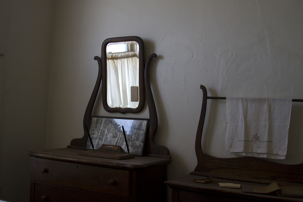
Images from Van Horn's Clark Hotel Museum


Saturday, March 09, 2013
Hiking in the Guadalupe Mountains

And through our association with the national park, it is our pleasure to offer a free, fun program to all hikers heading to the Guadalupes. Join the Peak Fitness Challenge, hike the trails in Guadalupe Mountains National Park and/or El Paso's Franklin Mountains State Park, and the miles you log qualify you for regular prize drawings!
 |
| Our Peak Fitness Challenge participants have run or hiked a combined 1,048 miles! |
 |
| Challenge participants have come from all over! |
Join the Challenge today!
Friday, March 08, 2013
Visit El Paso App!


Click HERE for all the info!
Subscribe to:
Posts (Atom)