Saturday, December 31, 2011

Gorgeous View and Delightful Geology Lesson!


Some of the best kept secrets around are the hiking trails at Fort Davis' Chihuahuan Desert Nature Center.  Atop the Clayton's Overlook (a magnificent 1.7 mile moderate/challenging hike) is a great exhibit that tells the geologic history of the entire area.  The Center's website says this:

"Opened in 2009, this exhibit is located on the highest point on the Nature Center property. The exhibit focuses on the geology of the Davis Mountains and tells a story of construction and destruction, of how mountains are built and torn down. The exhibit also shows how the culture and history of the region are linked to the geology."

Our favorite part of the experience?  The 360 degree view and an explanation of the prominent peaks and how they influenced the settlement of the land.  And there are several spots along the trail that offer jaw-dropping views of the land below and beyond.

Recently, Pam LeBlanc of the Austin American Statesman wrote about the Center and this trail in particular.  Click here to read that article. 

Building the trail and geology exhibit was a major undertaking....click here to download a document that tells the story!  One of the key forces in the development of the exhibit is featured in tomorrow's post!

Friday, December 30, 2011

Living Here

Ruin in Terlingua Ghost town
They can be found nearly everywhere in the region, traces of people's lives who made a place for themselves in our Chihuahuan Desert.  Adobe or stone, they represent the dreams, hard work and determination it takes to live in such wild land.  The ruins remain for us to ponder, to question if we had the stuff to make a life out here.

There are so many stories, too many to relate here.  But consider the story of J.O. Langford, who set out to establish his home and regain his health...he came to Big Bend in 1909.  The National Park's website says this about the Langfords:

"During the early 1900s the motto was “Go West Young Man.” In 1909 J.O. Langford heeded this call and headed for West Texas with his family. He came to this area not to find fame or fortune, but to regain his health. As a child living in Mississippi he had contracted malaria and his reoccurring bouts with this disease ravaged his body. In the lobby of a hotel in Alpine, Texas he heard tales of a spring that would cure anything:

“Stomach trouble, rheumatism, all sorts of skin diseases,” the old man vowed.
“I wonder why it is that I’ve never heard of those springs before. It looks like somebody would have tried to develop them like they’ve done at Hot Springs, Arkansas,” the Mississippian replied.
“Nothing down there but rattlesnakes and bandit Mexicans. And it’s too far away---that damned country promises more and gives less than any place I ever saw,” the old man replied.

After verifying the story with other townspeople, without even looking at the land, J.O. knew he had to have that spring. He rushed to the county surveyor’s office and filed his claim under the Homestead Act. Two weeks later the Langford family received word that the claim was theirs.
The Homestead Act stated that one had to have 3 years of continuous occupancy and $300 in improvements to the land in addition to a minimum bid of $1.50 per acre. Others had filed on this land but no one had been able to meet the requirements of the Act.
With his wife, Bessie, an 18 month old daughter and a baby on the way, the family began an eleven day journey to reach their new home. Today the trip from Alpine takes about 2 hours."

Read more about the Langfords and the establishment of the Hot Spring in Big Bend here.
And here, there's a book called, "Big Bend, a Homesteaders Story."

Click here to read other stories about places in Big Bend. 

We invite you to explore the region, but with a caveat...please respect private property and don't cross fence lines onto other people's land.   That's one of the reasons we champion the stories and the people who have a legacy in what's now state and national parks....they're open for all of us to explore!    

Thursday, December 29, 2011

Thinking ahead to Spring: Texas Rainbow Hedgehog Cacti

If the snow we've been getting is enough, and if we've had enough rain, we may see some lovelies like this come April or May.  This Texas Rainbow Hedgehog Cactus was photographed in Culberson County, just north of Van Horn a few years ago.  The blossoms open at daylight and close in the evening and last about a week. We hope to see some this year!

"Rainbow" in the common name refers to the contrasting colored bands on the stem, each reflecting a year's growth. The cactus grows between 4 1/2" to 9" though some get as tall as 18".

A good place to see a variety of cacti year round is the Cactus Greenhouse at Fort Davis' Chihuahuan Desert Nature Center and Botanical Gardens.

Wednesday, December 28, 2011

Hallie Stillwell, Rancher and Texas Legend

Hallie Stillwell's picture is on the "postcard" mural seen near the corner of Holland and 5th Street in downtown Alpine.

Her autobiography, I'll Gather My Geese, starts with,

"It was July 29, 1918.  I was a nervous bride-to-be and twenty years old. I should have been excited and elated that the handsomest and most eligible bachelor around had proposed marriage, but instead I could only think of Papa's words: "He's too old for you and he hasn't led a proper life.  That man drinks and gambles too much.  He's just not suitable for you, daughter!"

Hallie was a woman of determination, independence, spirit, with an unshakable love for our vast and wild lands of the Texas Mountain Trail region. For a treat, do yourself a favor to get a glimpse of the life of this remarkable woman....Click here to read about her life in the New York Times' obituary.

Click here to read about Hallie's Hall of Fame at the Stillwell Store,between the northeast corner of Big Bend National Park and Black Gap State Wildlife Preserve on Ranch Road 2627, just off 385.

You can buy Hallie's books at Front Street Books, in Alpine and Marathon.  (The Alpine store is right around the corner from the mural!)  Or at the Stillwell Store!

For more women's memoirs from the region, click here!

Tuesday, December 27, 2011

Snow at Jeff Davis County Courthouse

A dusting of snow, a madrone tree and the Jeff Davis County Courthouse, by Carolyn Nored Miller of Fort Davis.  It has been an honor to feature Carolyn's photographs this holiday week.  Thank you, Carolyn!

Monday, December 26, 2011

A rare snow graces one of our favorite historic sites, and one of the best preserved frontier forts in the West...Fort Davis National Historic Site!  Our thanks to Carolyn Nored Miller of Fort Davis for this rare snowy photo of the Fort!

Sunday, December 25, 2011

Horses

It is our honor to share this image from a Fort Davis area ranch, courtesy of Carolyn Nored Miller.  Merry Christmas everyone, from the Texas Mountain Trail!

Saturday, December 24, 2011

Sleeping Lion Mountain

The quaint town of Fort Davis, as seen by Carolyn Nored Miller.  This week we're featuring her photographs, thank you, Carolyn!

Friday, December 23, 2011

Snowy Fort Davis

We'd like to thank Carol Nored Miller of Fort Davis for this wintertime image of the Fort Davis bank, across from the historic Jeff Davis County Courthouse.  Thanks, Carolyn!

Thursday, December 22, 2011

Chihuahuan Desert Animals at the El Paso Zoo (and some other ones too!)

Javelina
Mexican gray wolf
The El Paso Zoo (open during the holidays, except December 25 and January 1) allows a close-up view of some of the animals of our Chihuahuan Desert ecosystem.  Pictured here are the Mexican wolf and javelina.   The Zoo is located on 35 acres of open space in El Paso and is a great place to visit with the family; it is accredited by the Association of Zoos and Aquariums.

Want to visit?  Click here to go to the Zoo's website, with more information about the animals, exhibits, and details about visiting!


You might have seen them from the road during your travels through the Texas Mountain Trail region...learn more about javelinas here.


The Mexican Gray Wolf used to roam our region, but is now nearly extinct in the lower 48.  Learn more about this animal from the US Fish & Wildlife Service, here.


What else can you see at the El Paso Zoo?  Take a look!


Wednesday, December 21, 2011

Morning light illuminates the prickly pear at Big Bend Ranch State Park

This was taken at the Papalote Llano campsite in Big Bend Ranch State Park in December, a campsite near the location of one of the old ranches in the park.  One of the benefits of getting off the main road in the park (remote enough by itself) is getting a deeper understanding of how vast and undisturbed the land is at Big Bend.

Pictured here is a windmill, near a neighboring campsite (and by neighboring, we mean it is a hike and you can't see one campsite from another), so the lesson about life on the land before it was a park is close by.

The park's website says, "By the 1880's several area ranches had been established and cattle, goats and sheep became a common sight on the landscape." Read more about the park's history--from prehistory and the archaeological record to present day--here.

More photos from the campsite:

Tuesday, December 20, 2011

Let's dream about warmer days, Smith Spring Trail at Guadalupe Mountains National Park


One of our very favorite hikes ANYTIME of the year, is the Guadalupe Mountains National Park's Smith Spring Trail.  Satisfying because of the desert and mountain views, shade, water, and the prospect of seeing wildlife (we've seen elk on this trail!) there's also a considerable presence of history that gives one pause to contemplate the reality of early life on this land.

At the trailhead is the historic Frijole Ranch, now a small museum with exhibits about life in this farm, and early life in the area.  The ranch was also a center of life in the area, the site of the area post office, dances and social gatherings and still on the property, the schoolhouse.  Click here to learn more about the history of the ranch.


In addition to exploring the ranch, allow an extra 1-2 hours to hike the 2.3 miles loop Smith Spring trail.  Bring your binoculars, for you may see wildlife and birds along the trail, especially near the shady oasis of Smith Spring, or open wetland of Manzanita Spring, also along the trail.  Read more about the trail.

We've put together a slideshow of what you'll see on the trail...click here!

Monday, December 19, 2011

Sunday, December 18, 2011

Saturday, December 17, 2011

Next year, harvest your tree at the Davis Mountains Preserve!

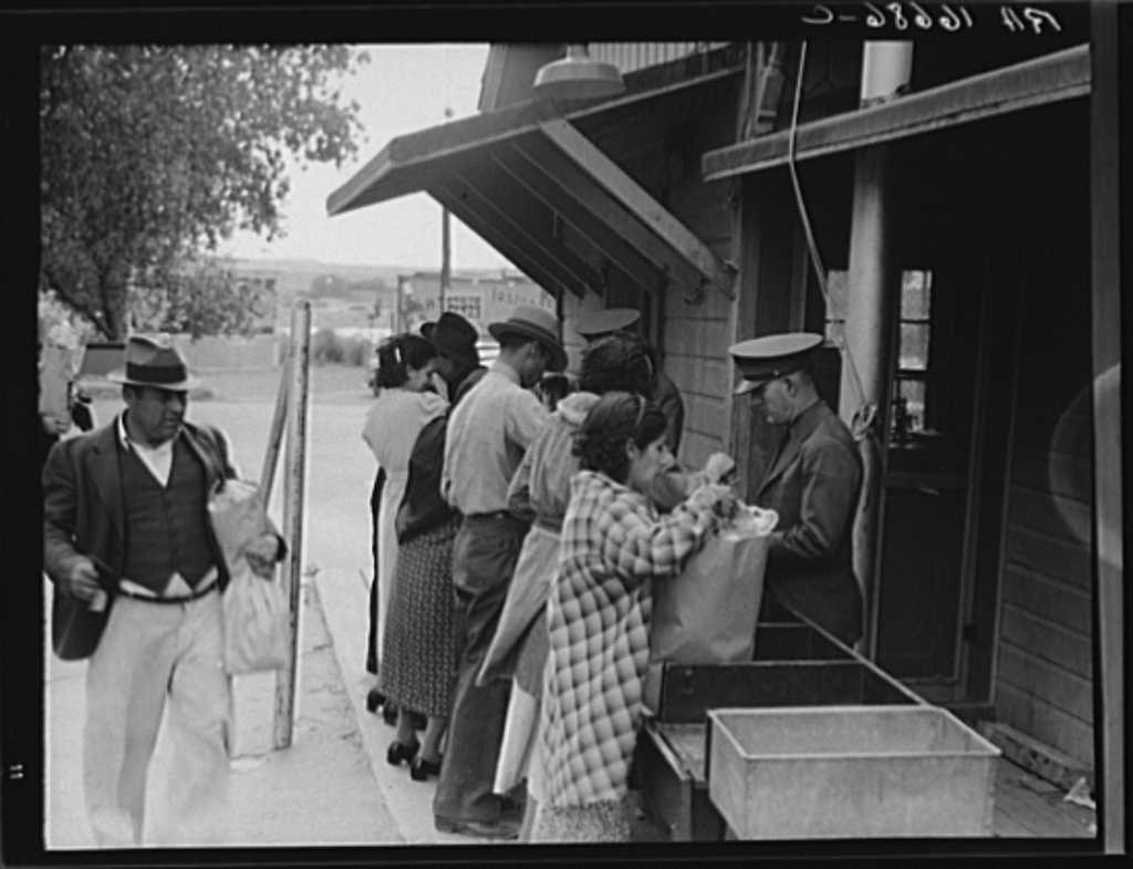
Superintendent of Fort Davis National Historic Site, John Morlock, stands in front of a Christmas tree harvested during Davis Mountains Preserve's Christmas Tree Hunt.  The tree stands in the Commanding Officers Quarters at the Fort and is decorated in the style as it would have been during the time the fort was active.  Photo:  Chris Pipes

227 Pounds of Food Donated and more than 100 Trees Cut at The Nature Conservancy’s 12th Annual Christmas Tree Hunt & Food Drive in the Davis Mountains

We received the following from the Nature Conservancy's Davis Mountains Preserve:

Members of the public were invited to bring handsaws, gloves and rope to join The Nature Conservancy on Saturday, December 3rd, and Saturday, December 10th, for the 12th Annual Christmas Tree Hunt at the Davis Mountains Preserve. There was no charge for this popular 'cut-your-own Christmas tree event, which ran from 9:00 a.m. to 4:00 p.m. on both days. Canned goods and donations were accepted for the Food Pantry of Jeff Davis County.


Participants were allowed to select trees from predetermined areas along the Madera Creek watershed where ponderosa pine, piñon pine and alligator juniper commonly occur.. Hikers were also welcomed to enjoy the preserve on these two open days. A total of 330 people visited the preserve and generously donated approximately 227 pounds of food and money for the Food Pantry.  Davis Mountains Project Director Chris Pipes estimated that 130 trees were harvested.

“Regular tree thinning is essential for severe wildfire prevention and for maintaining a healthy ecosystem in the Davis Mountains,” said Pipes. “By cutting their own trees, visitors are actually helping The Nature Conservancy manage this iconic West Texas landscape.”

Overseeing the event was Conservancy Preserve Technician Greg Crow, who was assisted by volunteers Heather Ainsworth-Dobbins, Gary Freeman, Pam Gaddis, Steve Kennedy, Van Robinson, and Liz Stanford, all of whom contributed its success.

To learn more about the Davis Mountains Preserve and other Texas lands the Conservancy works to protect, visit www.nature.org/texas.

To visit Fort Davis National Historic Site, click here.

Friday, December 16, 2011

Civilian Conservation Corps in Big Bend National Park

CCC Camp, Photograph, November 26, 1937; digital image, (http://texashistory.unt.edu/ark:/67531/metapth39508 : accessed December 16, 2011), University of North Texas Libraries, The Portal to Texas History, http://texashistory.unt.edu; crediting Marfa Public Library, Marfa, Texas.
 From Big Bend National Park's website, "If you have driven, hiked, or slept in the Chisos Mountains, you have experienced CCC history. In May 1933, Texas Canyons State Park was established; it was later renamed Big Bend State Park. Roads and trails were needed for the new park, and the CCC provided an ideal workforce. A year after the park was established, 200 young men, 80 percent of whom were Hispanic, arrived to work in the Chisos Mountains. The CCC's first job was to set up camp and develop a reliable water supply. The CCC boys faced many challenges, living in tents 85 miles from the nearest town, and facing extreme temperatures and weather. Eventually barracks replaced tents in the area of today’s Basin Campground.

In the early 1930s, the CCC built an all-weather access road into the Chisos Mountains Basin. They surveyed and built the seven-mile road using only picks, shovels, rakes, and a dump truck, which they loaded by hand. They scraped, dug, and blasted 10,000 truck loads of earth and rock and constructed 17 stone culverts, still in use today along the Basin road."


Thanks to our friends at the Portal To Texas History and Marfa Public Library, this image has been saved for all to enjoy!  The Portal also has an entire section for educators on the CCC in their Resources 4 Educators section.  Click here!

To learn more about the CCC in Big Bend National Park, click here.

To see more photographs of the CCC working in Big Bend National Park, on the park's website

Thursday, December 15, 2011

Dorothea Lange shoots El Paso, 1937

"State border plant inspection maintained by the United States Department of Agriculture between Mexico and the United States. Shoppers returning from Mexico (Juarez) to the United States (El Paso) over the bridge which carries all the traffic are required to open their packages for inspection" by Dorothea Lange, May 1937
Credit:  Library of Congress, Prints & Photographs Division, FSA/OWI Collection, LC-USF34-016898-C

"Plant quarantine inspectors examining packages brought over the bridge between Juarez, Mexico and El Paso, Texas. Families and housewives returning to their homes in El Paso after their Saturday marketing in Juarez, where they benefit by the present rate of exchange" by Dorothea Lange, May 1937
Credit: Library of Congress, Prints & Photographs Division, FSA/OWI Collection, LC-USF34-016686-C

There's a large collection of photos of our region in the Library of Congress, many by Dorothea Lange and other photographers at the Farm Security Administration.  (Click here to read about this wonderful collection.)  

The El Paso photographs range include many of Lange's photographs of the border crossings, of smelter processes, of buildings in the city, of former slaves.  


Wednesday, December 14, 2011

Tank wagon of cattle ranch on the highway near Marfa, Texas
Russell Lee, May 1939
Library of Congress, Prints & Photographs Division, FSA/OWI Collection, LC-USF33-012206-M2
 
We love browsing through the online archives of the Library of Congress for historical photographs from our region.  Here's an interesting image by Russell Lee from May of 1939 of a tank wagon on the highway near Marfa....thoughts on exactly where this was taken?  On the road to Marfa?  Or Fort Davis?

Tuesday, December 13, 2011

Holiday "Posada" at Fort Leaton!

The beautiful sky framed by the adobe walls of Fort Leaton

One of the loveliest "undiscovered" places in the region is holding a unique holiday event,  Fort Leaton (just east of Presidio) is sharing a Holiday "Posada" with visitors, one of the oldest Mexican holiday traditions.  From their website, "The traditional “posada” is a celebration in true Mexican fashion commemorating Mary and Joseph’s search for lodging in anticipation of their child’s birth. Traditional treats and entertainment will be provided in this “must see” border event."

When Dec 15, 2011
from 7:00 AM to 9:00 PM
Where Fort Leaton State Historic Site
Contact Phone 432-229-3613


Monday, December 12, 2011

Presidio Chapel of San Elizario

Ready for the holidays with luminaria, is the Presidio Chapel of San Elizario.  Nearby is the Los Portales Tourist Museum and Information Center.

The history of this beautiful building starts with earlier structures from 1789.  The present-day church was built on or near the original site of the old presidial chapel. "Presidio" in Spanish means "fort". The presidio, Spanish settlement and the missions were the building blocks of Spanish imperialism in the New World.  Read more of the history, here.


The National Park Service has a page for the Presidio Chapel of San Elizario, here.
A great resource for visiting the Mission Trail is here.
Visit the website for the El Paso Mission Trail Association here.
El Paso County has a wonderful history of the Mission Trail here.

Sunday, December 11, 2011

Colorado Canyon River Access

Along the River Road, between Lajitas and Presidio, there's a lovely place to stop and view the Rio Grande.  A popular "put in" place for river trips, there's few places as beautiful as this. 

Big Bend Ranch State Park's website says this about the area: 

"The Rio Grande/Rio Bravo corridor is an easily accessible area of the park for day use, including rafting, canoeing and free bank fishing. Several river access points are found within the park along FM-170. Colorado Canyon includes Class II and Class III rapids. This section of the river is not considered dangerous under normal flow conditions. The walls of Colorado Canyon, unlike the limestone canyons of Big Bend National Park and the Lower Canyons, are entirely of igneous rock."

For a list of outfitters working on the river, click here.

Saturday, December 10, 2011

Lincoln?

Look west on Hwy 67 between Marfa and Presidio, and yes, you'll see the profile of Abraham Lincoln!

Friday, December 09, 2011

On the River Road between Lajitas and Presidio, along Big Bend Ranch State Park
Many folks ask us, "So, what exactly IS the Texas Mountain Trail?"

They see the road signs all over the region, but wonder what they mean....

Well, the signs mark a historic figure 8 driving route established by Governor Connally in an effort to showcase the best of Texas in anticipation of HemisFair '68.  The Texas Mountain Trail is one of 10 original driving routes across the state.  Read more about it here.

"The Texas Heritage Trails Program (THTP) is based around 10 scenic driving trails created in 1968 by Gov. John Connally and the Texas Highway Department as a marketing tool. The trails were established in conjunction with the HemisFair, an international exposition that commemorated the 250th anniversary of the founding of San Antonio." 

Later, the state legislature saw the need to boost economic growth through tourism promotion and heritage preservation, and charged the Texas Historical Commission for building a program to benefit the state.

"In 1997, the Texas Historical Commission (THC) was charged by the State Legislature to create a statewide heritage tourism program. The THC based their program on the original driving trails, creating ten heritage regions: Brazos Trail Region, Forest Trail Region, Forts Trail Region, Hill Country Trail Region, Lakes Trail Region, Independence Trail Region, Mountain Trail Region, Pecos Trail Region, Plains Trail Region and Tropical Trail Region." 

You can read more about the Texas Historical Commission's Heritage Tourism efforts here.


The Texas Mountain Trail is a regionally-based independent 501 c 3 organization dedicated to serving Far West Texas, our communities and the travelers who visit us.  We serve all of our region, not just the communities along the original 1960s route.  We help communities preserve their heritage so future generations can appreciate and enjoy what makes us uniquely Texan.  We bring the Texas Mountain Trail region to all, through our Daily Photo blog, our website, our Facebook page, our Twitter posts, and other venues...so you can enjoy the mountains wherever you are!  Come visit us!

Thursday, December 08, 2011

Trail Run above Fort Davis National Historic Site (and yes, you can hike it too!)


We got up to a chilly, foggy morning on Sunday and headed to Fort Davis National Historic Site with the intention to tackle Hospital Canyon Trail with a trail run.  We've hiked this lovely trail many times and have also tried to run it, but that morning it just felt "right."

This is a trail steeped in history, for it provides a perfect vantage point to survey the land leading up to Fort Davis, perfect as a scouting and defensive position.  From the Fort's website:

"A key post in the defense system of western Texas, Fort Davis played a major role in the history of the Southwest. From 1854 until 1891, troops stationed at the post protected emigrants, freighters, mail coaches, and travelers on the San Antonio-El Paso Road. Today, Fort Davis is considered one of the best remaining examples of a frontier military post in the American Southwest."

"Fort Davis’s primary role of safeguarding the west Texas frontier against the Comanches and Apaches continued until 1881. Although the Comanches were defeated in the mid-1870s, the Apaches continued to make travel on the San Antonio-El Paso road dangerous. Soldiers from the post regularly patrolled the road and provided protection for wagon trains and mail coaches. The last major military campaign involving troops from Fort Davis occurred in 1880."

The trail head is at the back of the Fort, behind the historic hospital building, the scene of much preservation work today.  We ran up the 0.7 miles of the Hospital Canyon Trail, and then ran along the 0.3 miles of the North Canyon Trail where we stopped to take most of our photos.  From the top of the North Canyon Trail, it is easy to see the remains of that historic road, as well as the rest of the fort property.   The elevation gain is about 300 feet.

Most of the trail is rocky, while some of the trail surface is soft earth.  Portions of the trail saw fire this April, but the view and the experience isn't hampered.  There had been plenty of rain this summer to start the regrowth.

So we basically ran a mile up and a mile down on terrain that soldiers had traversed generations ago, making it more than just a challenging workout.   (And yes, it is a great hiking trail too!)


Wednesday, December 07, 2011

Beautiful sky!

A glorious Far West Texas sunset, sent to us by Texas Mountain Trail board member from Marathon, Wilma Schindeler.  Thanks, Wilma!

Tuesday, December 06, 2011

The Best of Holiday Charm: Van Horn's Lighted Christmas Parade

Every year, Van Horn holds an utterly charming holiday event, their Lighted Christmas Parade.  If you haven't experienced this very special community event, do yourself a favor and head to town on Saturday, December 10 this year.  The parade starts at 6:30 pm, but that's not all there is to experience in town:

Pecan Dessert Contest, 2:00 pm, at the historic Hotel El Capitan
Show and Sell, El Mercado Farmers Market, 209 W. Broadway 4-9pm  (food, arts, crafts, baked goods and products)

and then, yes, the 18th Annual Lighted Christmas Parade down Broadways Street, starting at 6:30 pm!