Monday, January 31, 2011

One of the best!


Whether you're a first-time visitor to the region, or a resident, you need to work a visit to the Museum of the Big Bend in Alpine into your schedule.  The exhibitions provide one of the best introductions to the history, culture and natural history of the entire area.  The museum is inviting and accessible; many of the exhibits are interactive, and children love them.  This is truly one of the best small museums you'll find anywhere--not just in Texas--anywhere.

Coming up soon is their signature exhibition of custom gear and western art, called Trappings of Texas.  This exhibition attracts the work of the finest cowboy artists working today, and is shown annually in conjunction with the Texas Cowboy Poetry Festival on the campus of Sul Ross State University.

Sunday, January 30, 2011

Views from Hueco Tanks!


Near El Paso, Hueco Tanks State Park and Historic Site offers adventurers bouldering, hiking, rock art, and birding opportunities.  This small park has so many assets (and some--namely the rock art--is so fragile) that entrance is limited to a certain number every day.  That shouldn't deter visitors from experiencing this special place...just plan ahead, call ahead, make reservations ahead of time.

One of our friend, TR, alerted us to this article about winter birding at Hueco Tanks...take a look!

Hueco Tanks is a site on the new Far West Texas Wildlife Trail map...for more information, click here.

For regional hiking information, visit our hiking page: www.texasmountaintrail.com/hike

Saturday, January 29, 2011

Views of Dog Canyon, Guadalupe Mountains National Park


One of the hidden gems of Texas's Guadalupe Mountains National Park (we say hidden because you need to backpack to it from the southern end of the park, or access it by car through New Mexico!) is Dog Canyon.  The National Park Services website says this:  "Dog Canyon lies in a secluded, forested canyon on the north end of the park at an elevation of 6,300 feet. Remote and far removed from civilization; it stands at the edge of the wilderness boundary, and offers an ideal location for quiet camping, birding, hiking, and solitude." 

The camping is wonderful too.  In fact, the campground has been rated among the best in the country for beautiful, relatively private sites.

This area experienced a forest fire last year, caused by a lightning strike.  However, the effects of fire are often misunderstood.  The area has bounced back, is still beautiful and has been ready for visitors for months.

For more regional hiking information, visit: www.texasmountaintrail.com/hike
This area is a wildlife viewing site on the new Far West Texas Wildlife Trail map.  For more information, click here.

Thursday, January 27, 2011

Hiker/Cyclist Friendly Accommodations--some offer pack lunches for your adventures!

Recently, we stayed at the Chisos Mountain Lodge in 
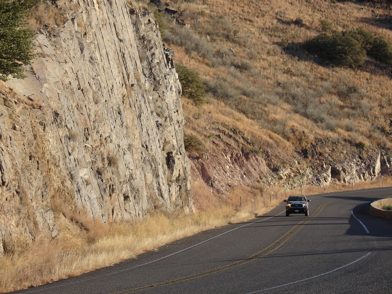
Big Bend National Park, and took advantage of our own Texas Mountain Trail cycle-friendly program.  We ordered their Veggie Hiker Lunch the night before our hike in the park at the Lodge's restaurant, and found it delicious AND convenient on the trail the next day.  (Pictured here on the Sam Nail Ranch trail, off Ross Maxwell Scenic Drive, a road with many hiking options, and one of the best bike rides in the park!)

The cycle-friendly program is intended to showcase hotels, B&Bs, historic tourist courts and other places to stay that are willing to offer special services to cyclists, such as secure in-room parking for bikes. Some will make you a pack lunch (sometimes with homemade treats like brownies!) and others will show you a local restaurant or store willing to prepare a sack lunch...a great benefit out in our wilderness!  All should have a bike pump ready for your use, and weather and regional cycling information.  Some may even offer sag support with advance notice!

For a full list of benefits and properties, please visit our cycling page:  www.texasmountaintrail.com/bike  We have cycle-friendly hotels participating in every corner of the region!

The Chisos Mountain Lodge Restaurant currently offers two hiker/cyclist pack lunch options, and both are delicious on the trail or on the road! 

Hikers Lunch
A Perfect On The Go Meal Option
Choice Of Turkey, Ham, Or Peanut Butter And Jelly
Sandwich On Wheat Bread With Apple Or Orange,
Bottled Water, Cookies And Chips
$8.95
and


Veggie Hiker Lunch
A Blend Of Chickpeas, Sesame Tahini, Garlic And Citrus Along with Cucumbers, Tomatoes, Black Olives,
Green Onions, And Green Leaf Lettuce
Wrapped In A Herb Tortilla With Apple Or Orange,
Bottled Water, Cookies And Chips
$10.95

Stay tuned...in future days, we'll post more about lunches and other services available from our other cycle-friendly hotel properties!

Wednesday, January 26, 2011

A special surprise for your Valentine!

Here's a special idea for your sweetie for Valentines Day: Get a Valentine, Texas postmark on your card!

Each year, the children of Valentine compete to design the postmark. Prepare your Valentine card addressed to recipient with postage and put into a second envelope addressed with postage to “postmaster, Valentine, Texas 79854"

Last year's postmark is pictured here!

Tuesday, January 25, 2011

Mexican Gray Wolf

The Mexican Gray Wolf once populated the Chihuahuan Desert, including western Texas. 
This wolf lives at the El Paso Zoo;  read about this beautiful animal here.  Would you like to visit the zoo next time you're in El Paso?  For information, click here.

Monday, January 24, 2011

Hello, from Dell City!

Tucked away in the northern part of our region, in the shadow of the highest peak in Texas is Dell City.  A small, but friendly agricultural community, it sits west of Guadalupe Mountains National Park, and everyone in town has a magnificent view of Guadalupe Peak and El Capitan!  Founded in the 1940s, this little community of approximately 500 is named, "Valley of the Hidden Waters," even though it is within sight of the Salt Flats west of the national park.  A map is here.

Sunday, January 23, 2011

Our week concludes with Cattail Falls, Big Bend National Park

Our week of featuring the photographs of Al Capizzo concludes with this image from Cattail Falls in Big Bend National Park

Al tells us this about the photograph:  "In the photo you can see grayer, darker rock on left and lighter rocks on the right. The darker rock is a much harder rock than the lighter rock. It is essentially "bedrock" which was forced up through the softer rock and is what we see as the mountain tops, sticking up today. The creek is following a fault line between the two types of rock, and is there because this was a place it could start wearing a channel through the softer rock. You do see some grayer rocks on the right of the creek, but those are just boulders and rock that fell from the higher levels and ended up here. Of course all this took place before I was born, so I'm just passing along what I've heard!"

We'd like to tip our hat again, and thank Al for sharing his photos with us all week.  Thanks, Al! 

Saturday, January 22, 2011

Sam Nail Ranch in Big Bend National Park

Windmill tower at Sam Nail Ranch in Big Bend National Park along Ross Maxwell Scenic Drive, by this week's featured photographer, Al Capizzo.  This part of the park is a great birding area, and is a site on our new Far West Texas Wildlife map.

Al tells us he really enjoys this part of the park, "one windmill there is still providing some water, and their are pecan trees (!) growing around the remaining adobe walls of the original home."

Friday, January 21, 2011

Driving in Big Bend Ranch State Park

This week's featured photographer, Al Capizzo, really captures the feeling of driving in the remote areas of Big Bend Ranch State Park.  We love the wide open spaces, the wild land, the incredible vistas and the intimate access to wildlife.

Drivers need to plan ahead, bring plenty of water, and a good spare or two.  If you want to drive on backcountry roads, take a few minutes to download and read this "4x4 Guide to Big Bend Ranch State Park."

And thanks again to Al, for sharing this wonderful photo!

Thursday, January 20, 2011

Cattail Falls, Big Bend National Park

A couple of hikers in Big Bend National Park in the Cattail Falls area, another image from this week's featured photographer, Al Capizzo.

For regional hiking information, visit: www.texasmountaintrail.com/hike

Wednesday, January 19, 2011

Wild Burros by Al Capizzo

Our guest photographer this week is Al Capizzo, from tiny Trout, Texas in the eastern part of the state.  "All I can say to the residents of West Texas is, cherish and protect what you have, it really is a spectacular land."

Stay tuned for more images from Al this week of our Texas Mountain Trail region! 

Tuesday, January 18, 2011

Rancherias Trail, Big Bend Ranch State Park

Our week featuring photographer Al Capizzo continues with this wonderful photograph of Rancherias Trail in Big Bend Ranch State Park

Al shared these thoughts about our region, "It is wildly beautiful. It is largely empty. It is majestic in a very elemental and raw way."   That's certainly true, especially for Big Bend Ranch State Park, the largest and wildest in Texas.

Monday, January 17, 2011

Al Capizzo Week begins!

One of the Trail's Facebook friends started sending us these amazing photos of the region and we invited him to share more images on the Daily Photo Blog...we're happy he agreed!  Meet Al Capizzo, of Troup, TX and aCapizzo Photography.

Al tells us he first came to the region in 2006, with a visit to Big Bend National Park.  Says Al, "I've also been rather avidly outdoorsy for most of my life, so nature photography was a natural extension of that....To say I fell in love with the area would certainly be an understatement. More like bewitched, enthralled, enchanted."  

Stay tuned all week for more of Al's images of the Texas Mountain Trail region!   We think you'll enjoy them!

Sunday, January 16, 2011

Drive to the Observatory

Texas 118, here taking visitors to the McDonald Observatory, is the highest elevation paved road in Texas.

This road is also part of the Scenic Loop, one of the most beautiful driving and cycling route in the state.  Click here to read more about cycling this road!

Our thanks again to Pete S. for sharing his photographs with us all week!

Saturday, January 15, 2011

Ranches

Several huge cattle ranches, most of them measured in square miles, border Texas Highways 118, 166 and 17, which comprise the Scenic Loop.

Thanks to Pete S. for sharing his photos all week long!

Friday, January 14, 2011

Mountain Valley

An oak-studded mountain valley gracefully ascends to Texas 118 and a memorial marking a long-ago accident.

Another beautiful vista of the drive from Fort Davis to the Observatory from our friend, Pete S!  Thanks, Pete!

Thursday, January 13, 2011

McDonald Observatory at Dawn

Astronomers work all night at McDonald Observatory's Hobby-Eberle telescope, among the world's most powerful.

Our thanks to Pete S. for sharing this wonderful photograph of McDonald Observatory.  Stay tuned all week for Pete's photos of sights from Fort Davis to the Observatory!

Wednesday, January 12, 2011

Ridgeline of Mt. Livermore

The high ridgeline of the Davis Mountains lights up just after dawn. Highest point is 8,378-foor Mt. Livermore, visible from several points along the Scenic Loop.

Mt. Livermore is part of the Davis Mountains Presere, where there's an Open Day on March 12.  Read more here.

We've started a page on the Scenic Loop for our website's cycling section...take a look at this page in progress, here!

Tuesday, January 11, 2011

Sotol

Huge sotol plants, a Far West Texas native, grace the entrance of McDonald Observatory.

Thanks to Pete S. for sharing this photo with us!

Monday, January 10, 2011

Sunrise

Gaudy sunrises often decorate winter mornings in the Davis Mountains and Far West Texas. This one was photographed from the McDonald Observatory.

Thanks to Pete S. for sharing this photo with us!  Look for his photos of vistas from Fort Davis to the Observatory all week!

Sunday, January 09, 2011

Manhattan Heights Neighborhood

El Paso is a surprising city.  Most folks traveling never get off I-10 and that's a shame.  There are places in the city worthy of a little exploration, a little discovery.  One of these is the historic Manhattan Heights neighborhood, a gracious area adjacent to the Scenic Drive overlook.  Not only are there terrific views of the city from there, but also incredible vistas from Memorial Park.  And there's the Muncipal Rose Garden, too!  (Pictured here is a restored gas station, The neighborhood has an amazing history, for it was built on a copper smelting site.  (As you explore the neighborhood, you'll notice the street names:  Copper, Gold, Silver, etc!)  Read more about it here. 

Many of the homes were designed by local promiment local architects to reflect Prairie or Spanish styles--including Otto Thorman, Mabel Welch, William G. Wuehrmann, and Gustavo and Henry Trost.

For a slideshow of images from the neighborhood, click here.  The neighborhood has been rated one of El Paso's "most walkable," for a map, click here.

Saturday, January 08, 2011

Sunrise on Hwy 54

This beautiful view is part of the El Capitan to El Capitan Heritage Bike Route, which for all you motorists, can also be driven!  Hwy 54 connects Van Horn to Guadalupe Mountains National Park, and takes you through some of the most unspoiled and scenic land in the state of Texas. 
For other regional scenic (and historic) bike routes and driving routes, visit: www.texasmountaintrail.com/bike

For general regional travel information, visit: http://www.texasmountaintrail.com/

Friday, January 07, 2011

Beautiful on the outside, beautiful on the inside


Our last day in this series on the three El Paso Missions shows the interiors of each.  In order, (top to bottom):  San Elizario, Ysleta, Socorro.  The adobe buildings are BEAUTIFUL on the outside, as you've seen in our previous postings, but we want to encourage you to stop and experience the inside of each mission too.  For more information on the Missions and tour opportunities, click here to visit the El Paso Mission Association website. 

Thursday, January 06, 2011

Ysleta Mission

From the El Paso Mission Trail Association website:

"Ysleta del Sur, established in 1680 by Antonio de Otermin and Fray Francisco de Ayaeta and built with the sweat and labor of the Tigua Indians has gone through many transformations. La Mision de Corpus Christi de San Antonio de la Ysleta del Sur as it is known today is built of adobe bricks, clay, straw, and Spanish vigas.  Today it is one of the crowning jewels along the Mission Trail and the community around it. 

The beautiful silver dome and unique Tigua art blend together two cultures that have lasted close to 400 years along the Southwest's Camino Real.

The Mission is the oldest continuously active parish in the state of Texas, and the community of Ysleta is the oldest town in Texas, it is dated back to 1682.  The Tigua Indians were forced to flee their pueblo at Isleta, New Mexico and establish the agricultural community of Ysleta del Sur Pueblo. 
The Rio Grande flooded the mission once in 1744 and again in 1829.  In 1851 the current Mission was originally a rectangular stock of blocks.  The façade was later changed to a pitched, gable shape.  About 1897, the gable was enlarged and a beehive-shaped dome bell tower was added and later painted to the silver color we see today, capping three centuries of natural disasters."

 
The association is offering tours
of all the missions on El Paso's Mission Trail.   On your next trip to El Paso, check it out!
Thanks to the THC's Randy Mallory for this great photo of the Mission's interior!

Wednesday, January 05, 2011

A special message for our 1000th post!

Wow, we're at 1000 posts for the Texas Mountain Trail Daily Photo Blog!  We've been thinking of a special post to celebrate this milestone....so here goes:

If you're a fan of the Big Bend, take note.  If you respect the work of the men and women of our Armed Forces, listen up.

Find a few minutes alone, then click on this link to watch a videoIt will be the best thing you do all day.  You'll go on a river trip with veterans.  You'll go to Santa Elena Canyon in Big Bend.

We're so pleased to take this opportunity to introduce you to ActiVets, a program that takes veterans surviving the wounds of war--particularly post-traumatic stress syndrome--to the Big Bend.  Their motto?  "Healing the Wounds of War with Wilderness." 

You know what a trip to the wilderness can do for us in your own life...turns out it can really make an impact with those who are suffering from the effects of war.  River trips have the ability to heal.  So does the quiet and the beauty of the Rio Grande and our Chihuahuan Desert.  So does companionship of other recovering soldiers.  That's why we want you to know about ActiVets. They say the need is acute and growing as more and more of our soldiers are coming back hurt.  If you haven't already, please click here to go to their website to read more.
Consider this quote from a participating soldier:

"I would like to once again thank you for the experience I had in the park. My wife sees a difference in me. Even my kids and I have bonded.  I often think of those 4 days. I didn't know it would have such an impact on my life. I laugh more, I do not feel like hurting people anymore. I am back in school now, and I am doing good in my subjects. . ."

ActiVets is doing important work.  They'd appreciate your help.  Please consider sharing our favorite place in the world--the Texas Mountains--with a soldier.

Tuesday, January 04, 2011

Socorro Mission Restoration

During the restoration project

The beauty of the Socorro Mission (featured yesterday) is evident to us because hardworking individuals and visionary organizations started a five year restoration project in 2000.  Today, we feature some photographs of the interior of the Mission during that restoration, some links to historical photographs of the mission, and a history of that restoration.

A TREAT:  During the Texas Centennial in 1936, a series of documentary photographs were taken of the mission, and are now held in the Historic American Building Survey in the Library of Congress.  Take a look, click here!  And here!

Feature article about the mission and the restoration, written by one of the key restoration partners.  Beautiful photographs are included in this article.

Community Cornerstones Partnership did the restoration.  Their website, says this about the mission and the restoration:  "Spanish and Piro Indian refugees fleeing the Pueblo Revolt founded the village of Socorro del Sur in 1680. The new community soon erected a church building of jacal construction. By 1744 a larger, permanent church was built. Beautiful vigas painted with flowers and geometric designs supported the roof. In 1829, devastating floods destroyed the church, but parishioners were able to salvage many of the vigas and corbels. The nave of the present structure, La Purísima, was dedicated in 1843. The bell wall, sanctuary and transepts, and right sacristy and mortuary were added by 1887.

Unfortunately, in the twentieth century the exterior of the church was cement plastered and a concrete collar was installed. Trapped moisture, aggravated by a leaking roof, damaged the walls and rotted the ends of several vigas and corbels. The west wall began to slump. In 1999, Cornerstones' Pat Taylor helped complete a preservation plan describing the history of La Purísima, the current condition of the building, and the work needed to stabilize it and restore its original beauty. The preservation process has included making 20,000 adobe bricks to replace damaged adobes in the foundation, walls, and roof parapets. Extensive structural repairs and interior mud and lime plastering have been completed. The restoration is now in its final phase that includes interior finish details, and front façade/bell tower repairs. In November 2004, the site received a Save America's Treasures appropriation award. Preservation is scheduled to be complete by the end of 2005."
A detailed history of the restoration project is also available at the El Paso County website.

Would you like to visit the El Paso Missions?  A new tour service is now available.  Click here for more information! 

Monday, January 03, 2011

Socorro Mission on our Mission Trail


This is our second of five days this week featuring the El Paso County Mission Trail, and today we're showing Socorro Mission and the adjacent cemetery.  The building is on the National Register of Historic Places.

From the El Paso Mission Trail Association website, a bit of its history: "The Rio Grande played havoc on the locations of this charming mission.  It took its name from Socorro of the North (New Mexico).  The Piro Indians fled this area after the Pueblo Revolt of 1860 and established their new home.  Sixty Piro families along with fifteen Spanish families dedicated the mission to Nuestra Senora de Limpia Concepcion de los Piros de Socorro del Sur (Our Lady of the Immaculate Conception of the Piros of Socorro of the South).  
      In 2005 the mission completed a 10 year restoration that showcases some original cypress roof supports called vigas (beams) that were decorated by the Piro Indians.  The striking architecture reflects the vibrant local community with numerous historic haciendas within walking distance:  Casa Apodaca, The Bookery, Casa Ortiz, and Casa Carbajal."

See how the craftsman echoed the architecture of the mission in the grave's marker?  The Mission is still home for an active congregation, and a respectful stroll through the cemetery reveals a great deal about the community still using the mission as its church.

Tomorrow, we'll feature photographs from the restoration, plus provide a link to some neat 1936 photographs of the Mission now in the Historic American Buildings Survey in the Library of Congress!

You can visit the missions on your own, or take advantage of a new tour service...for more information, click here.

Note:  Wednesday is a special day for us, and we'll take a break in the series on the El Paso Mission Trail to celebrate our 1000th post in this blog!

Sunday, January 02, 2011

Discover our Mission Trail!

Here's a shot of the beautiful chapel at San Elizario, part of El Paso County's Mission Trail, one of the jewels of our region.  When you're in the area, plan to visit one of the three missions--all are active congregations--and discover the beauty of the architecture and the incredibly rich history of early exploration (the Camino Real de Tierra Adentro--the Royal Road of the Inter Land--came to being when Don Juan de Oñate forged  through the Chihuahuan desert and into Santa Fe, New Mexico in 1598).   and settlement of the area.  To book a tour of the mission trail, click here to read more!

Saturday, January 01, 2011

Now THAT'S a campsite!

Our recent camping trip to Big Bend Ranch State Park revealed so many of Far West Texas' assets, the reasons people keep coming back to our corner of the state:

  • Our campsite, as you can see, allowed us a private wilderness experience.  And how rare is that these days?  Pretty darn rare. 
  • We were surrounded by evidence of geological history, with extinct volcanoes in the area, and volcanic rock all around.
  • As we drove into the park, we passed right by some ancient rock art, pictographs of human figures
  • The nearby Fort Leaton and the town of Presidio were established early, in 1683.
  • This land was traveled by the Comanche and Buffalo soldiers, and by refugees from the Mexican Revolution a 100 years ago.
  • A few miles away in the park's center, sits the historic ranch house dating back to 1908, and there was plenty of evidence of old ranch buildings throughout the park.
  • We heard coyote in the night, and in the morning the birding was excellent. (The park is on the new regional wildlife/birding map.) We hiked and if we'd brought our mountain bikes, world-class "epic" rides were available right there in the park. 
We had adventure, history, archaeology, nature, geology all right there waiting for us.  And we can't wait to go back!