The folks at Wheels for Meals and the Jeff Davis Food Pantry pointed us to a neat interview with this (great) bike ride's founder, Margaret O'Connell, and we wanted to share some excerpts with you. This is a GREAT ride, for a GREAT cause on some of the most scenic roads you'll find anywhere! (Read the entire interview posted on wheelbrothers.com site last year, here!) Please note: This year's ride is October 5!
What was the motivation behind starting the tour and who benefits from it?
I have personally participated in many charity bike rides and saw the
power they have to not only raise money, but to raise awareness. When I
moved to Fort Davis, I quickly realized the the Pantry was perhaps the
single most crucial nonprofit in JDCty, because without the supplemental
food it provides, children would not do well in school, families would
suffer. Nearly 20% of the JDC population receives supplemental and
school lunch foods from the Pantry.
How have they been able to utilize the funds in the past?
Funds raised through the WfM event make up almost 1/2 of the Pantry’s
annual budget, paying for tons of foods and paying for operations of the
building facilities to ensure our doors stay open.
Logistically, can you give us an idea how many volunteers, finances, and planning it takes to put on this event?
We have over 40 volunteers providing support at two pit stops and lunch
stop, driving SAG vehicles, and information at the registration. The
Riders’ $50 registration fee covers the costs of the t-shirts, pit stop
snacks and drinks. We have nearly 30 sponsors this year donating dollars
and in-kind goods to support the ride. Most of the sponsors donatipons
and ALL of the riders’ fund raising monies go directly to services. Even
all the the food and beverages at the post-ride cookout are donated by
sponsors and our board members.
What was the most rewarding experience throughout the years hosting this event?
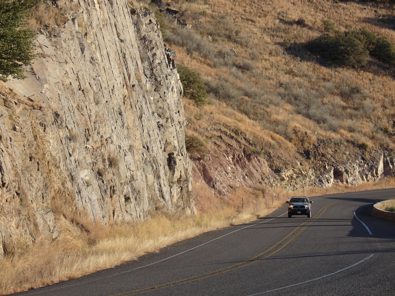
Hearing the positive comments from our riders and volunteers about the
quality of the ride: the beauty of the scenery, the enthusiasm of the
volunteers, the quality of the pit stops and qauntity of snacks, the
good and rewarding feelings the riders and volunteers have about their
constributions to helping the Pantry’s consumers.
Want to learn more? Want to ride? Click here to learn more specifics about the ride. Click here to learn more about the Food Pantry!
Your daily photo of gorgeous Far West Texas featuring Big Bend National Park, the Davis Mountains, Guadalupe Mountains National Park, El Paso and all points in between!
Showing posts with label scenic loop. Show all posts
Monday, August 05, 2013
Wheels for Meals!
Labels:
biking,
Buffalo soldiers,
cycling,
Fort Davis,
scenic loop,
Valentine
Monday, February 04, 2013
Look UP at Night: Feb 2-23 Best Evening Viewing of Mercury AND Guide to Visiting McDonald Observatory
![]() |
Photo by Randy Mallory for the Texas Historical Commission |
Locals and veteran travelers already know it: Our region has a distinguished jewel in McDonald Observatory. Located atop the Davis Mountains on the "Scenic Loop," it is a place visitors regularly put high up on their bucket list. Intrigued? Here's an EXCELLENT article about visiting the Observatory and taking in a couple of their public programs, from our friend, Sheila Scarborough of Perceptive Travel Blog.
Click here to read the Observatory's webpage on visiting the facility. Heading to the region for Spring Break? Click here to see all the special Spring Break programming at McDonald Observatory.
![]() |
The view of the Davis Mountains from the top of McDonald Observatory (click on the photo for a closer view!) |
Labels:
Davis Mountains,
Fort Davis,
McDonald Observatory,
scenic loop
Wednesday, August 17, 2011
Riders on Hwy 90
We've been working on cycling itineraries that take visitors to some pretty interesting places in the region. This view of Hwy 90 is part of our Texas Mountain Ride! from Adventure Cycling's Bike Overnights blog, which starts in Marathon, and goes to Alpine, Fort Davis and Marfa.
What attracts cyclists (from beginners to racers) to our region? Great scenery, little to no traffic, and lovely places to stop and enjoy!
We also have the El Capitan to El Capitan Heritage Bike Ride (Van Horn to Guadalupe Mtns National Park), Ride to the Post (Marathon to Post Park), and Fort Davis' Scenic Loop.
Take a look at our website's cycling page for a list of cycle-friendly hotels, B&B's, historic motor courts and modern motels! Check it out at www.texasmountaintrail.com/bike
Sunday, July 10, 2011
You can see for miles and miles with little trace of man
One of our favorite places is a road connecting Hwy 90 to Fort Davis' Scenic Loop...FM 505 is a long, mostly flat stretch of road that allows you to see large swaths of land and sky with very little evidence of man in the way. It is a wonderful place to see raptors and sometimes pronghorn. To get there, head south from Van Horn, through Valentine. About seven miles south of Valentine, there's a turnoff to the east...that's 505.
This road had a starring role in a sweet film about small town Texas (starring Fort Davis), called "Dancer, Texas, Pop. 81". In fact a view of the road begins this movie!
For more information on movies shot in the region, visit our webpage, here!
This road had a starring role in a sweet film about small town Texas (starring Fort Davis), called "Dancer, Texas, Pop. 81". In fact a view of the road begins this movie!
For more information on movies shot in the region, visit our webpage, here!
Labels:
Fort Davis,
movies,
scenic loop,
Valentine,
Van Horn
Sunday, January 16, 2011
Drive to the Observatory
Texas 118, here taking visitors to the McDonald Observatory, is the highest elevation paved road in Texas.
This road is also part of the Scenic Loop, one of the most beautiful driving and cycling route in the state. Click here to read more about cycling this road!
Our thanks again to Pete S. for sharing his photographs with us all week!
This road is also part of the Scenic Loop, one of the most beautiful driving and cycling route in the state. Click here to read more about cycling this road!
Our thanks again to Pete S. for sharing his photographs with us all week!
Labels:
cycling,
Fort Davis,
McDonald Observatory,
scenic loop
Saturday, January 15, 2011
Ranches
Several huge cattle ranches, most of them measured in square miles, border Texas Highways 118, 166 and 17, which comprise the Scenic Loop.
Thanks to Pete S. for sharing his photos all week long!
Friday, January 14, 2011
Mountain Valley
An oak-studded mountain valley gracefully ascends to Texas 118 and a memorial marking a long-ago accident.
Another beautiful vista of the drive from Fort Davis to the Observatory from our friend, Pete S! Thanks, Pete!
Wednesday, January 12, 2011
Ridgeline of Mt. Livermore
The high ridgeline of the Davis Mountains lights up just after dawn. Highest point is 8,378-foor Mt. Livermore, visible from several points along the Scenic Loop.
Mt. Livermore is part of the Davis Mountains Presere, where there's an Open Day on March 12. Read more here.
We've started a page on the Scenic Loop for our website's cycling section...take a look at this page in progress, here!
Mt. Livermore is part of the Davis Mountains Presere, where there's an Open Day on March 12. Read more here.
We've started a page on the Scenic Loop for our website's cycling section...take a look at this page in progress, here!
Labels:
cycling,
Davis Mountains,
Fort Davis,
Mt. Livermore,
scenic loop
Monday, June 21, 2010
Cholla in bloom on the Scenic Loop
Cholla is in bloom all over the region. Here's a shot from Fort Davis' Scenic Loop.
Wednesday, February 10, 2010
Seldom Driven: Hwy 118 looking south
Looking south from the exact spot as yesterday's post on Hwy 118, this is one of the seldom driven portions of the original driving route, the Texas Mountain Trail. Taken between Kent (the I-10 turnoff) and the scenic loop around Fort Davis, this stretch of highway provides scenic vistas of spectacular ranchland.
For more about the history of our program and the development of the circa 1968 driving routes around the state of Texas, click here. Though there is a clearly defined driving route from that era, our program has developed to serve the entire six-county region from Brewster County (which has Big Bend National Park) to El Paso County and the New Mexico state line.
Tuesday, February 09, 2010
Seldom Driven: Hwy 118 Looking North
For a few days, we're featuring some of the less-traveled portions of the original driving route of the Texas Mountain Trail. Today and tomorrow, we'll feature Hwy 118 between Kent (the I-10 turnoff) and Fort Davis at exactly the same place. Today, the view is looking north.
Monday, February 08, 2010
The Seldom Driven parts of the original Texas Mountain Trail
The Texas Mountain Trail began as a simple driving route to publicize the state of Texas prior to the 1968 HemisFair in San Antonio, but now we serve the entire six county region of Far West Texas. You can read more about our history, here.
There was an original driving route, and our blue highway signs are still posted on that "Figure 8" that covers most corners of the region. Naturally, some parts of the route get more traffic than others. Today we start a short series on the roads a little less traveled--and let's face it--even our highly traveled roads don't get THAT much traffic, but we thought you might like to see the more remote places along the route.
For the next couple of days we'll focus on Hwy 118, from Kent (the amazing old merchantile building is pictured here at the turnoff from I-10--stop in the store, and you'll step back a century!) to the top of the Scenic Loop (Hwy 166) heading toward Fort Davis. Drive along with us!
Saturday, June 20, 2009
Flowering Cholla on the Scenic Loop
An enormous cholla blooms on the Scenic Loop west of Fort Davis. One of the most beautiful drives anywhere, the Scenic Loop is a "must do" when visiting the region. The community of Fort Davis, the Fort Davis National Historic Site and Davis Mountains State Park, and the famed McDonald Observatory are all on the loop. Plus there's great mountain vegetation and wildlife to view!
Tuesday, April 28, 2009
View from McDonald Observatory

For more information about visiting McDonald Observatory, click here.
For information about cycling in the region, visit www.texasmountaintrail.com/bike
For information about favorite motorcycle rides in the region, visit www.texasmountaintrail.com/motorcycle
Thanks to Matt Walter, Curator of History at the Museum of the Big Bend in Alpine for this great photo!
Subscribe to:
Posts (Atom)